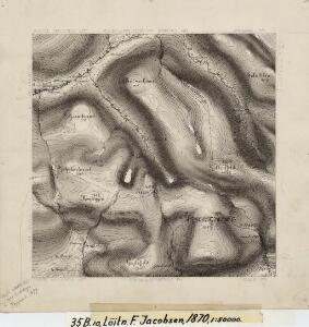
Maps of Hornindal

35B 10
1 : 50000 Frithjof Jacobsen
1318-1 Stryn
1 : 50000 Statens kartverk
1318-1 Stryn
1 : 50000 Norges Geografiske Oppmåling
1318-1 Stryn
1 : 50000 Statens kartverk
1318-1 Stryn
1 : 50000 Norges Geografiske Oppmåling
1318-1 Stryn
1 : 50000 Statens kartverk
1219-2 Geiranger
1 : 50000 Norges Geografiske Oppmåling
1219-3 Hjörundfjorden
1 : 50000 Statens kartverk
1219-3 Hjörundfjorden
1 : 50000 Norges Geografiske Oppmåling
1219-3 Hjørundfjorden
1 : 50000 Statens kartverk
35B 11
1 : 50000 E. Lund
35B 2; 35B 6; 35B 7
1 : 50000 Christian Due
35D 1; 35D 5; 35D 6
1 : 50000 Solem
35A 12; 35B 9; 35C 4
1 : 50000 Frithjof Jacobsen
35D 2
1 : 50000 E. Lund
Jostedalsbræen med tilgrænsende strøk

Trigonometrisk grunnlag, vedlegg 68-8
1 : 250000
Kartblad 122: Situasion af de Bergenhuusske Regimenters Grændser udi Indre Sogn saaledes som samme vilde blive efter den af det Første Bergenhuusiske Regiment udkastede Plan

Norge 55-17: Accurat landcaart over Norges Rige anden Part
1 : 300000 G. Bordin
Museumskart 217-68: Kart over Havbankerne Langs den Norske Kyst fra Stadt til Smølen
1 : 200000 M. Lyng Den Geografiske Opmaaling
Trigonometrisk grunnlag, vedlegg 68-11
1 : 250000
X
1 : 400000 N. Franck
Spesielle kart: Tyngdeanomalikart, Ã...lesund
1 : 250000 NGO
X
1 : 400000 N. Franck
Trigonometrisk grunnlag, Squelet-Cart 58: Oversigtskart over de i Aarene 1864 og 1865 bestemte Punkter
1 : 350000 F. Sejersted
Spesielle kart 122-6: Postkart over Norge
1 : 400000 Toralf à ̃yen
XI
1 : 400000 N. Franck
X
1 : 400000 N. Franck
Spesielle kart 186: Sogn og Fjordane fylkesplankart
1 : 280000