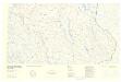
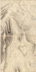
Maps of Engerdal

32D-11-vest
1 : 10000 Carl Wendel Bremer
Mil nr 278
1 : 10000 Johan Henrich Ramm
38B 2; 38B 3
1 : 50000 Finn Qvale
32D 11
1 : 50000 Marius Widerøe | Georg Peter Leganger Mamen
2018-1 Engerdal
1 : 50000 Norges Geografiske Oppmåling
2018-1 Drevsjø
1 : 50000 Statens kartverk
2018-1 Drevsjø
1 : 50000 Norges Geografiske Oppmåling
2018-1 Drevsjø
1 : 50000 Statens kartverk
32D 7; 32D 11 (halv)
1 : 50000 Widerøe
Mil nr 277
1 : 10000 Johan Henrich Ramm | Carl Wendel Bremer
Mil nr 268
1 : 10000 Eilert Woldemar Preben Ramm | Carl Wendel Bremer
32D-10-øst
1 : 10000 Carl Wendel Bremer
Mil nr 287
1 : 10000 Johan Friderich Næser
2018-1 Drevsjø
1 : 50000 Statens kartverk
2018-1 Drevsjø
1 : 50000 Statens kartverk
32D Engerdalen
1 : 100000 Torgrim Lundtvedt | H. C. Wanggård
32D Engerdal
1 : 100000 Torgrim Lundtvedt | H. C. Wanggård
32D Engerdal
1 : 100000 Torgrim Lundtvedt | H. C. Wanggård
32D Engerdalen
1 : 100000 Torgrim Lundtvedt | Carl Christian Olberg
32D Engerdal
1 : 100000 Torgrim Lundtvedt | H. C. Wanggård
Portefølje nr 57
1 : 100000 Schilling
Portefølje nr 57
1 : 100000 Schilling
Kartblad 166b-4: Wej-Cart over det Aamodske Compagnie; 166b-4

Østerdalen
1 : 250000
Spesielle kart 144-b: Flykart à ̃sterdalen
1 : 250000 NGO
Trigonometrisk grunnlag, Squelet-Cart 65-10

Norge 55- Accurat landcaart over Norges Rige anden Part
1 : 300000 G. Bordin
Geologiske kart 22: Geologisk kart over det østlige af Hamar Stift
1 : 400000 O. E. Schiøtz Norges geologiske undersøkelse
Geologisk kart over det Söndenfjeldske Norge
1 : 400000 Nordost-Blatt Kjerulf, Theodor ; Dahll, Tellef Carl Schwenzens