Maps of Elverum

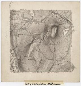
26C 8
1 : 50000 Johannes Solem
26C 8 øst
1 : 10000 Carl Wendel Bremer | Hans Lemmich Juell
Mil nr 193
1 : 10000 Hans Lemmich Juell
26C 8 vest
1 : 10000 Carl Wendel Bremer | Hans Lemmich Juell
Mil nr 193
1 : 10000 Hans Lemmich Juell
Fra Søndre Rustad til Korperud
1 : 20000 J. H. Reichborn
Mil nr 192
1 : 10000 Hans Lemmich Juell
26C 4
1 : 50000 Johannes Solem
26C 4
1 : 50000 Johannes Solem
26C 12
1 : 50000 Johannes Solem
Mil nr 183
1 : 10000 Johan Henrich Ramm | Eilert Woldemar Preben Ramm
Mil nr 194
1 : 10000 Eilert Woldemar Preben Ramm | Johan Henrich Ramm
26C 4 vest
1 : 10000
Fra Grundset til Johannesstua
1 : 20000 J. H. Reichborn
Kartblad VI: Vei-kaart over den trondhjemske Kongevei fra Christiania til Røraas gjennom Eidsvold, Rommedal, Levthen og Østerdalen
1 : 20000 J. H. Reichborn
Mil nr 183
1 : 10000 Johan Henrich Ramm | Eilert Woldemar Preben Ramm
26C-7
1 : 10000 Hans Lemmich Juell
26D 5 vest
1 : 10000 Ramm
26C 4 øst
1 : 10000
26C Åmot
1 : 100000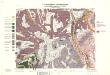
Geologisk kart 32a: Den Geologiske Undersøgelse, Rektangel 26 Åmot
1 : 100000 P. Krohn | Ths. Münster | Øgaard Norges geologiske undersøkelse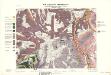
Geologisk kart 32b: Den Geologiske Undersøgelse, Rektangel 26 Åmot
1 : 100000 Øgaard | Ths. Münster | P. Krohn Norges geologiske undersøkelse
26C Åmot
1 : 100000 Arnt Magnus Andreassen Øgaard | C. Pedersen
26C Åmot
1 : 100000 Nicolai Franck | Arnt Magnus Andreassen Øgaard
26C Åmot
1 : 100000 C. Pedersen | Arnt Magnus Andreassen Øgaard
Portefølje nr 40
1 : 100000
26C Åmot
1 : 100000 C. Pedersen | Arnt Magnus Andreassen Øgaard
Portefølje nr 40
1 : 100000
26C Åmot
1 : 100000 C. Pedersen | Arnt Magnus Andreassen Øgaard