Maps of Nes

24B 4
1 : 50000 Lund
24B 4
1 : 5000 Lund
E33-11, E33-12
1 : 50000 Georg Otto Lorange | Adler Gleditsch
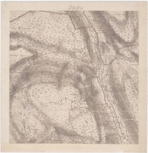
1616-2 Gol
1 : 50000 Statens kartverk
1616-2 Gol
1 : 50000 Statens kartverk
1616-2 Gol
1 : 50000 Norges Geografiske Oppmåling
18D 12; 19C 9; 24B 4; 25A 1
1 : 50000 Lund
E33-11
1 : 50000 Adler Gleditsch | Marius Widerøe | Axel P. Printz | Einar Halle | Berthold Dahl
E33-10-n/2, E33-10-s/2
1 : 50000 Sverre Fermann Hermansen | Axel P. Printz | Hans Løken
1616-2 Gol
1 : 50000 Norges Geografiske Oppmåling
1616-2 Gol
1 : 50000 Statens kartverk
E33 aust Tunnhovd
1 : 100000
E33-10
1 : 50000 Thorolf Ingar Ween
E32-5
1 : 50000 Toralf Øyen
E32-6
1 : 50000 Adler Gleditsch
E32-6
1 : 50000 Adler Gleditsch | Erling Bjørstad
E33-9, E33-10
1 : 50000 Niels Sire | Hans Løken | Thorolf Ingar Ween | Sverre Fermann Hermansen | Ørnulf Arthur Rød | Axel P. Printz | Berthold Dahl
24B 3
1 : 100000 Lund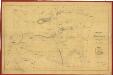
Oversigtskart over Næs sameie i Hallingdal
1 : 20000 Peter Aas
Portefølje nr 38
1 : 100000 Vibe
Portefølje nr 38
1 : 100000 Vibe
Spesielle kart 58-3: Kart over Drammenselvens Flødningsdistrikt
1 : 100000 Seip | Thurmann
Spesielle kart 123-2: Kart over Drammensvassdraget
1 : 100000 Toralf à ̃yen
Kartblad 63 vest: Det yttere Hallingdahlske Infanterie Compagnie District

Kartblad 63 øst: Det yttere Hallingdahlske Infanterie Compagnie District

Hallingdal
1 : 250000
Hallingdal
1 : 250000
Trigonometrisk grunnlag, Squelet-Cart 65-6

Trigonometrisk grunnlag, Squelet-Cart 39: Skeletkart
1 : 400000 Th. Broch