Maps of Torsby kommun

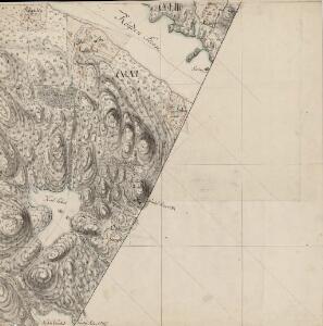
21C 1 nø
1 : 10000
21C 1 vest
1 : 10000 Holst
Mil nr 124
1 : 10000 Johan Jacob Rieck (Rick)
21C 1
1 : 50000 Daniel Tønnesen
Trigonometrisk grunnlag, vedlegg 29: Fundament Mensul for Quadrat-Miilen No 115
1 : 10000 Rick
21C 5
1 : 50000 Wilhelm Ernst Ramm Gran
21C 1 nv
1 : 10000 Holst
21C Røgden
1 : 100000
21C Røgden
1 : 100000 Arnt Magnus Andreassen Øgaard | H. Hagen
21C Røgden
1 : 100000 Arnt Magnus Andreassen Øgaard | H. Hagen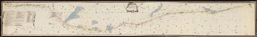
NRA GA 4
Friedenreich | Thodal | Ratkind | Holm | Marelius | Hejde
Portefølje nr 33
1 : 100000
Portefølje nr 33
1 : 100000
Kartblad 46: Wej-Cart over det Soleurske Compagnies District
Leegaard
Spesielle kart 103-11: Flötningskart over Glommens vassdrag
1 : 1000 Einar Sigurd Ween
Geologiske kart 121-P: Kart med magnetisk totalfelt. Torsby
1 : 250000 Norges geologiske undersøkelse
Finnskog
1 : 250000
Trigonometrisk grunnlag, Squelet-Cart 65-7

Finnskog
1 : 250000
Geologisk kart over det Söndenfjeldske Norge
1 : 400000 Ostblatt Kjerulf, Theodor ; Dahll, Tellef Carl Schwenzens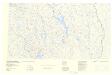
Spesielle kart: Tyngdeanomalikart, Hamar
1 : 250000 NGO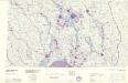
Statistikk 43-8- Bosettingskart over Hamar. Blad 8
1 : 250000 Statistisk Sentralbyrå
Geologisk kart 87: Kvartærgeologisk kart, Oppland
1 : 250000 Gunnar Holmsen Norges geologiske undersøkelse
IX
1 : 400000 L. Arentz
IX
1 : 400000 L. Arentz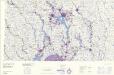
Statistikk 43-8-2: Bosettingskart over Hamar. Blad 8
1 : 250000 Statistisk Sentralbyrå
Spesielle kart 12: Kart over de projecterede Jernbanelinier fra Christiania gjennem Akershus og Smaalenenes Amter
1 : 400000
IX
1 : 400000 L. Arentz
Spesielle kart 122-3: Postkart over Norge
1 : 400000 Toralf à ̃yen