Maps of Østre Toten

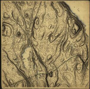
20C 10
1 : 20000 Niels Finckenhagen
20C 10 b
1 : 50000 Finckenhagen
Kartblad 2: Kart over Veien fra Eidsvold til Gausdal og til Skydsstationen Holmen i Øyer
J. H. Reichborn
20C 10 a
1 : 50000 Frithjof Jacobsen
Far Garsjøsetra til Torsætra
J. H. Reichborn
Kartblad 48: Militair Cart over det Stangeske Compagnie District
Falck
20C Eidsvoll
1 : 100000 Gjestvang | Torgrim Lundtvedt
20C Eidsvoll
1 : 100000 H. C. Wanggård | Torgrim Lundtvedt | Gjestvang
20C Eidsvoll
1 : 100000 Gjestvang | Torgrim Lundtvedt
20C Eidsvoll
1 : 100000
Kartblad 4 Cituations-Cart over det Edsvoldske Compagnies Distrigt
Neumann
20C Eidsvoll
1 : 100000 Torgrim Lundtvedt | Gjestvang | H. C. Wanggård
1916-3 Lena
1 : 50000 Statens kartverk
1916-3 Toten
1 : 50000 Norges Geografiske Oppmåling
26A 1; 26A 2
1 : 50000
1916-3 Toten
1 : 50000 Norges Geografiske Oppmåling
1916-3 Østre Toten
1 : 50000 Statens kartverk
1916-3 Østre Toten
1 : 50000 Statens kartverk
1916-3 Lena
1 : 50000 Statens kartverk
1916-2 Tangen
1 : 50000 Norges Geografiske Oppmåling
1916-2 Tangen
1 : 50000 Norges Geografiske Oppmåling
1916-2 Tangen
1 : 50000 Statens kartverk
1916-2 Tangen
1 : 50000 Statens kartverk
1916-2 Tangen
1 : 50000 Statens kartverk
1916-2 Tangen
1 : 50000 Norges Geografiske Oppmåling
20C 6
1 : 50000 Frithjof Jacobsen
Kartblad III: Vei-kaart over den trondhjemske Kongevei fra Christiania til Røraas gjennom Eidsvold, Rommedal, Levthen og Østerdalen
1 : 20000 J. H. Reichborn
26A 2
1 : 20000 Trygve Frivold Graff-Wang | Jacob Hvinden Haug
20C 9
1 : 50000 Lund