Maps of Sør-Odal

20B-6-sv
1 : 10000 Hans Nicolai Archtander | Hans Frederich Tambs
Mil nr 99
1 : 10000 Niels Stockfleth Darre
20B-6-vest
1 : 10000 Hans Frederich Tambs | Hans Nicolai Archtander
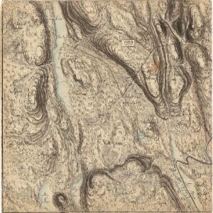
Trigonometrisk grunnlag, vedlegg 18: Fundament Mensul for Quadrat-Milen No 92
1 : 10000 Niels Andreas Wibe | Hans Nicolai Archtander
20B 6
1 : 50000 Johannes Solem
20B 5
1 : 50000 Johannes Solem
Nr. 8; felt 3 halve sør og 7
1 : 25000 J. Natrud
20B 2
1 : 50000 Johannes Solem
Nr. 8; felt 5; 6; 9 og 10
1 : 25000 O. J. Broch | H. Broch
20B 5 øst
1 : 10000 Niels Stockfleth Darre
Mil nr 98
1 : 10000 Johan Henrich Ramm
20B 5 sø
1 : 10000 Ramm | Niels Stockfleth Darre
20B-6-sø
1 : 10000 Hans Frederich Tambs | Hans Nicolai Archtander
Nr. 8; felt 2 og 6 (en del)
1 : 25000 I. Smith-Kielland
20B-2-nv
1 : 10000 Ramm
2015-2 Kongsvinger
1 : 50000 Norges Geografiske Oppmåling
Trigonometrisk grunnlag, vedlegg 15: Fundament Mensul for Sammenbindelsen af de gamle Operationer
1 : 50000 Hans Lemich Juell | Johan Henrik Ramm
2015-2 Kongsvinger
1 : 50000 Statens kartverk
2015-3 Ström
1 : 50000 Statens kartverk
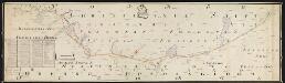
Spesielle kart 104-1: Kart over Fredrikshaldsvassdraget med Mangenvassdraget
1 : 50000 Finn Qvale
20B Kongsvinger
1 : 100000
20B Kongsvinger
1 : 100000
20B Kongsvinger
1 : 100000
Trigonometrisk grunnlag, vedlegg 17: Fundament Mensul for Quadrat-Milen No 91
1 : 20000 Hans Nicolai Archtander | Niels Andreas Wibe
20B Kongsvinger
1 : 100000 H. Hagen | Torgrim Lundtvedt
Kartblad 44: Vej-Cart over det Oudahlske lette Infanterie Compagnies District
NRA GA 3
Thodal | Friedenreich | Hejde | Marelius | Holm | Ratkind
Kartblad 45: Wej-Cart over det Wingerske lette Infanterie Compagnies District

Portefølje nr 33
1 : 100000