Maps of Sør-Odal

20B 10 vest
1 : 10000 Heramb | Hansen
Mil nr 110
1 : 10000 J. F. Ramm
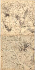
20B 10 nv
1 : 10000 Heramb | Hansen
20B 10 nv
1 : 10000 Heramb | Hansen
20B 10 sv
1 : 10000 Heramb | Hansen
20B 10 sv
1 : 10000 Heramb | Hansen
Fra Sander til Hernes
1 : 20000 J. H. Reichborn
20B 10
1 : 20000 Munthe
20B 10
1 : 50000 Gunnar Anfin Lange
20B 10
1 : 50000 Gunnar Anfin Lange | Amundsen
Nr. 8; felt 13
1 : 25000 O. Berg
Nr. 8; felt 14 (en del)
1 : 25000 Fleischer
2015-1 Brandval
1 : 50000 Norges Geografiske Oppmåling
2015-1 Brandval
1 : 50000 Norges Geografiske Oppmåling
2015-4 Skarnes
1 : 50000 Statens kartverk
Kartblad II: Kart over Postveien fra Gaarden Kløften i Ullensager Sogn om Magnor til Rigsgrændsen
1 : 20000 J. H. Reichborn
Nr. 8; dele av felt 5 og 9
1 : 25000 R. Roscher Nielsen
Nr. 8; felt 5; 6; 9 og 10
1 : 25000 O. J. Broch | H. Broch
Nr. 8; felt 10 halve nord
1 : 25000 J. Nielsen
20B 9
1 : 50000 Gunnar Anfin Lange | Amundsen
Kartblad III: Kart over Postveien fra Gaarden Kløften i Ullensager Sogn om Magnor til Rigsgrændsen
1 : 20000 J. H. Reichborn
Fra Fulu til Tarven
1 : 20000 J. H. Reichborn
20B 6
1 : 50000 Johannes Solem
Nr. 8; felt 14 (to dele)
1 : 25000 Halle
20B-6-nv
1 : 10000 Hans Nicolai Archtander | Hans Frederich Tambs
20B 9 sør øst
1 : 10000 Peter Myhre
2015-1 Brandval
1 : 50000 Statens kartverk
Trigonometrisk grunnlag, vedlegg 3 Fundament Kaartover den Østre Halvdeel af Qvadrat Milen No 120
1 : 10000
20B Kongsvinger
1 : 100000 H. Hagen | Torgrim Lundtvedt