Maps of Ullensaker

20A 6 nø
1 : 10000 Andreas Samuel Krebs
Ekserserplasskart; Gardermomaalingen
1 : 12500 Helset | Hatledal
Fra Smedstua til Fjellberg
1 : 20000 J. H. Reichborn
Spesielle kart 145: Gardermoen
1 : 50000
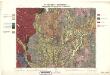
1915-2 Jessheim
1 : 50000 Statens kartverk
1915-2 Ullensaker
1 : 50000 Statens kartverk
1915-2 Ullensaker
1 : 50000 Norges Geografiske Oppmåling
Fra Fløgstad til Smedstua
1 : 20000 J. H. Reichborn
Kartblad II: Vei-kaart over den trondhjemske Kongevei fra Christiania til Røraas gjennom Eidsvold, Rommedal, Levthen og Østerdalen
1 : 20000 J. H. Reichborn
Ekserserplasskart; Kart over Gardermoen
1 : 12500 A. Thirud
Ekserserplasskart; Kart over Gardermoen
1 : 25000 A. Thirud
20A 7 vest
1 : 20000 Jørgen Scielderup Grimseth
20A 6 nv uten grenser
1 : 10000 Andreas Samuel Krebs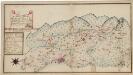
Kartblad 173: Situations Chart over det Nannestadske Captain Hans Abelsteds andfortroede Dragoner Compagni District
C. A. Hiorth
1915-2 Ullensaker
1 : 50000 Norges Geografiske Oppmåling
Ekserserplasskart; Gardermoen sydlig blad
1 : 50000
1915-2 Ullensaker
1 : 50000 Norges Geografiske Oppmåling
1915-2 Ullensaker
1 : 50000 Statens kartverk
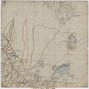
Trigonometrisk grunnlag, vedlegg 23: Fundament Kaart over Qvadrat Milene No 105 og 106
1 : 50000
Kartblad 65: Wey-Cart over det Eidswoldske lette Infanterie Compagnie District

20A Nannestad
1 : 100000 Johan Ferdinand Nordmann | Ole Engh
20A Nannestad
1 : 100000 Johan Ferdinand Normann | Carl Christian Olberg
20A Nannestad
1 : 100000 Johan Ferdinand Normann | Carl Christian Olberg
Kartblad 4 Cituations-Cart over det Edsvoldske Compagnies Distrigt
Neumann
Kartblad 43: Wej-Cart over det Næsiske lette Infanterie Compagnies District

Kartblad 42: Vej-Cort over det Ullensagerske Compagnies District (Under Norske Jægerkorps)
C. Hals
Trigonometrisk grunnlag, vedlegg 58
1 : 50000
20A Nannestad
1 : 100000 Johan Ferdinand Normann | Carl Christian Olberg
20A Nannestad
1 : 100000 Carl Christian Olberg | Johan Ferdinand Normann