Maps of Ullensaker

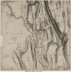
20A 11 sv
1 : 10000 Peter Myhre
20A 11 sv
1 : 10000
20A 12 nordvestre del, versjon 2
1 : 10000
Spesielle kart nr 49: Kart over den nordligste deel af Vormen Elv
1 : 5000
1915-2 Ullensaker
1 : 50000 Statens kartverk
1915-2 Jessheim
1 : 50000 Statens kartverk
1915-2 Ullensaker
1 : 50000 Norges Geografiske Oppmåling
Ekserserplasskart; Kart over Gardermoen
1 : 25000 A. Thirud
20A 7 vest
1 : 20000 Jørgen Scielderup Grimseth
20A 11 nv
1 : 10000 Peter Myhre
20A 11 nv
1 : 10000 Peter Myhre
20A 11 nv
1 : 10000 Peter Myhre
1915-2 Ullensaker
1 : 50000 Norges Geografiske Oppmåling
1915-1 Eidsvoll
1 : 50000 Norges Geografiske Oppmåling
1915-2 Ullensaker
1 : 50000 Norges Geografiske Oppmåling
1915-1 Eidsvoll
1 : 50000 Statens kartverk
1915-1 Eidsvoll
1 : 50000 Statens kartverk
1915-2 Ullensaker
1 : 50000 Statens kartverk
Trigonometrisk grunnlag, vedlegg 23: Fundament Kaart over Qvadrat Milene No 105 og 106
1 : 50000
Trigonometrisk grunnlag, vedlegg 22: Kvadratmilien No 97, kvadratmilen No 58
1 : 10000
Kartblad 65: Wey-Cart over det Eidswoldske lette Infanterie Compagnie District

20A Nannestad
1 : 100000 Johan Ferdinand Nordmann | Ole Engh
20A Nannestad
1 : 100000 Johan Ferdinand Normann | Carl Christian Olberg
20A Nannestad
1 : 100000 Johan Ferdinand Normann | Carl Christian Olberg
Kartblad 4 Cituations-Cart over det Edsvoldske Compagnies Distrigt
Neumann
Kartblad 43: Wej-Cart over det Næsiske lette Infanterie Compagnies District

Trigonometrisk grunnlag, vedlegg 30: Fundament Tabel Quadrat-Miilen No 116 og 117
1 : 10000
Kartblad 42: Vej-Cort over det Ullensagerske Compagnies District (Under Norske Jægerkorps)
C. Hals
Trigonometrisk grunnlag, vedlegg 58
1 : 50000