Maps of Ås

14D 4 sø del av nø/4
1 : 10000 Dahl
Mil nr 54
1 : 10000 Johan Henrich Ramm | Hans Lemmich Juell
14D 4 nø; 14D 4 sø; 15C 1 nv; 15C 1 sv
1 : 25000 Arnt Magnus Andreassen Øgaard | Torgrim Lundtvedt
14D 4 øst
1 : 10000 Hans Lemmich Juell
14D 4 vestre del av nø/4
1 : 10000 Mathias Andersen Ween
15C 1 nv (sv/4)
1 : 10000 Dahl
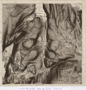
14D 4
1 : 20000 Øverland
14D 4
1 : 40000 H. Hansen
14D 4 øst; 15C 1 vest
1 : 25000 Torgrim Lundtvedt | Arnt Magnus Andreassen Øgaard
Museumskart 217-43: Specialkart over Kristianiafjorden fra Kristiania til Drøbak
1 : 50000 H. N. Bergh | C. F. Wille Den Geografiske Opmaaling
15C 5 (geometrisk hovednet)
1 : 50000
G35-5
1 : 50000 Andreas Theodor Walle
1914-3 Ski
1 : 50000 Norges Geografiske Oppmåling
1914-3 Ski
1 : 50000 Statens kartverk
1914-3 Ski
1 : 50000 Norges Geografiske Oppmåling
1914-4 Oslo
1 : 50000 Statens kartverk
1914-4 Oslo
1 : 50000 Statens kartverk
1914-4 Oslo
1 : 50000 Norges Geografiske Oppmåling
1914-3 Ski
1 : 50000 Statens kartverk
1914-4 Oslo
1 : 50000 Statens kartverk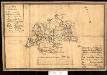
Kartblad 34: Militairt Cart over Nordrefollaugske Compagnie District
L. Rein | Petter Prydz
14D Oslo
1 : 100000 E. Heiberg | H. N. Bergh
14D Oslo
1 : 100000 Johan Gulbrandsen Natrud | Ole Engh
14D Oslo
1 : 100000 Johan Gulbrandsen Natrud | Ole Engh
14D Oslo
1 : 100000 Johan Gulbrandsen Natrud | Ole Engh
14D Oslo
1 : 100000 Johan Gulbrandsen Natrud | Ole Engh
Geologiske kart 50: Geologisk kart over Christiania omegn
1 : 100000 Theodor Kjerulf
Kartblad 23: Kart over det Aggerske Compagnie District
Fridrich Helle Grønvold
Kartblad 36: Militairisk Chart over det Enebakske Compagnie District
N. F. Lihme