Maps of Re

14B 1
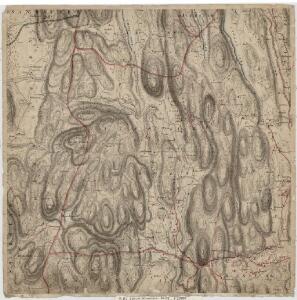
1 : 20000 M. Rynning
1813-4 Holmestrand
1 : 50000 Statens kartverk
1813-4 Holmestrand
1 : 50000 Norges Geografiske Oppmåling
1813-4 Holmestrand
1 : 50000 Statens kartverk
1813-4 Holmestrand
1 : 50000 Norges Geografiske Oppmåling
14B 2 vest
1 : 50000 Kristen Gran Gleditsch
14B 5 sø
1 : 50000 David Ebbesen
Kartblad 175: Situations Carte over det Nordre Jarlsbergsche Compagnie District
Christian Hagemann
14B 1
1 : 50000 Marius Widerøe
1813-4 Holmestrand
1 : 50000 Norges Geografiske Oppmåling
1813-4 Holmestrand
1 : 50000 Statens kartverk
14B 1
1 : 50000 Carl Ludvig Soelberg
Kartblad 33: Vei-Kart over det Lauerdahlske Compagnie Distict
Onserud
Kartblad 12: Geographisch_carte over de angrændsende Compagnier udi Jarlsbergs Græwskab af det 1ste Aggerhuusche og 2det Smaaleensche Infanterie-Regiment
Oppen
Kartblad 27: Kart over det Sandeske Compagnie District
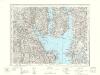
14B Moss
1 : 100000
14B Moss
1 : 100000 E. Heiberg | H. N. Bergh
14B Moss
1 : 100000
14B Moss
1 : 100000 H. N. Bergh | E. Heiberg
14B Moss
1 : 100000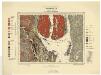
Geologiske kart 70: Norges geologiske undersøkelse. Kristianiafeltet-Moss
1 : 100000 W. C. Brøgger | Jakob Schetelig Norges geologiske undersøkelse
14B Moss
1 : 100000
14B Moss
1 : 100000
Kartblad 13: Militair Cart over det Westre Jarlsbergske Compagnie District
F. C. Hejdemark
9D 9
1 : 50000 Einar Christian Ingvald Nandrup Michelsen
14B 5 vest
1 : 50000 Bjarne Gjølme | David Ebbesen
Kartblad 28: Kart over det Waaleske Compagnie District

14A 4
1 : 50000 Rynning (Nils S. D. Eckhoff)
14A 4
1 : 20000 M. Rynning