Maps of Siljan

14A 4
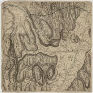
1 : 20000 M. Rynning
14A 4
1 : 50000 Rynning (Nils S. D. Eckhoff)
1713-1 Siljan
1 : 50000 Statens kartverk
1713-1 Siljan
1 : 50000 Statens kartverk
Kartblad 33: Vei-Kart over det Lauerdahlske Compagnie Distict
Onserud
9C 3 9C 7 9C 11 14A 3
1 : 100000 Ramm
14A Kongsberg
1 : 100000 Torgrim Lundtvedt | Ole Tolstad | Ellef Nilsen
14A Kongsberg
1 : 100000 Torgrim Lundtvedt | Ole Tolstad | Ellef Nilsen
14A Kongsberg
1 : 100000
Kartblad 27: Kart over det Sandeske Compagnie District

Trigonometrisk grunnlag, dublett 27-2: Kart over trigonometriske punkter foretatt i rundt 1795
1 : 200000
14B 1
1 : 50000 Carl Ludvig Soelberg
Kartblad 12: Geographisch_carte over de angrændsende Compagnier udi Jarlsbergs Græwskab af det 1ste Aggerhuusche og 2det Smaaleensche Infanterie-Regiment
Oppen
1713-1 Siljan
1 : 50000 Norges Geografiske Oppmåling
1713-1 Siljan
1 : 50000 Norges Geografiske Oppmåling
1713-1 Siljan
1 : 50000 Norges Geografiske Oppmåling
1713-1 Siljan
1 : 50000 Norges Geografiske Oppmåling
14B 5 sø
1 : 50000 David Ebbesen
14B 1
1 : 50000 Marius Widerøe
Kartblad 175: Situations Carte over det Nordre Jarlsbergsche Compagnie District
Christian Hagemann
1813-4 Holmestrand
1 : 50000 Statens kartverk
1813-4 Holmestrand
1 : 50000 Norges Geografiske Oppmåling
14B 5 vest
1 : 50000 Bjarne Gjølme | David Ebbesen
1813-4 Holmestrand
1 : 50000 Statens kartverk
1813-4 Holmestrand
1 : 50000 Statens kartverk
1813-4 Holmestrand
1 : 50000 Norges Geografiske Oppmåling
1813-4 Holmestrand
1 : 50000 Norges Geografiske Oppmåling
14A 3
1 : 50000 Nils S. D. Eckhoff | E. Meidell
14A 8
1 : 50000 Rynning