Maps of Suldal

12A 5; 12A 9
1 : 50000 E. Lund
B36-6; B36-12
1 : 50000 Toralf Øyen
B36-5; B36-6
1 : 50000 Thorolv Ingar Ween | Kaare Kvisgaard
C36-1
1 : 50000 Olav Dahle
B36 aust Vikedal
1 : 100000
B36 aust Vikedal
1 : 100000
B36 aust Vikedal
1 : 100000
B36 aust Vikedal
1 : 100000
B36 aust Vikedal
1 : 100000
B36-4-n/2; B36-5-n/2; B36-6-n/2; B36-10-s/2; B36-11-s/2; B36-12-s/2
1 : 50000 Andreas Theodor Walle | Kaare Kvisgaard | Gunvald Hagene
B36-6
1 : 50000 Adler Gleditsch
B36-11; B36-12
1 : 50000 Toralf Øyen
1213-1 Vindafjord
1 : 50000
1213-1 Vindafjorden
1 : 50000 Statens kartverk
1213-1 Jelsa
1 : 50000 Statens kartverk
1214-2 Etne
1 : 50000 Statens kartverk
1214-2 Etne
1 : 50000 Statens kartverk
1214-2 Etne
1 : 50000 Statens kartverk
1214-2 Etne
1 : 50000 Norges Geografiske Oppmåling
B36-4; B36-5
1 : 50000 Andreas Theodor Walle | Thorolv Ingar Ween | Gunvald Hagene | Kaare Kvisgaard
1213-1 Vindafjord
1 : 50000 Norges Geografiske Oppmåling
1214-2 Etne
1 : 50000 Norges Geografiske Oppmåling
1213-1 Vindafjorden
1 : 50000 Statens kartverk
1213-1 Vindafjorden
1 : 50000 Statens kartverk
C36-1; C36-2; C36-3; C36-7; C36-8; C36-9
1 : 50000 Gustav Adolf Tajet
1214-2 Etne
1 : 50000 Statens kartverk
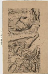
Kartblad 154: Situations Cart over det 3. Ryfølchske Compagnie Destrict
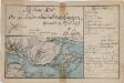
Kartblad 130- Situations Carte over det Søndre Sundhordlehnske Compagnie District; versjon 1
Lorentz Henrik Møller Segelcke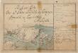
Kartblad 130-2: Situations Carte over det Søndre Sundhordlehnske Compagnie District; versjon 2
Lorentz Henrik Møller Segelcke