Maps of Rakkestad

Jegerkorps nr 6-3: Kart over en del av Rokke, Skjeberg, Varteig, Degernes, Rakkestad, Ons og Eidsberg, del 3 øst
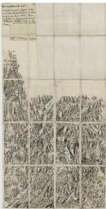
1 : 13000 Brynie | Meyer | von Staffeldt
Mil nr 21
1 : 10000 Hans Bassøe
10C-7-vest
1 : 10000 Stocfleth
10C 7
1 : 20000 Grimsæth
Mil nr 21
1 : 10000 Hans Bassøe
10C-7-øst
1 : 10000 Stocfleth
Mil nr 20
1 : 10000 Hans Bassøe
10C-6-øst
1 : 10000 Stocfleth
Jegerkorps nr 22: Kart over Bergs sogn og en del av Aremark, vestre del
1 : 10000
10C 10 øst; 10C 11
1 : 50000 Finn Abrahamson
Jegerkorps nr 13: Kart over Rakkestad med annekser og Varteig anneks til Thunø
1 : 10000 von Staffeldt | von Stabell
10C 3 nord; 10C 7
1 : 25000 Finn Abrahamson
1913-1 Sarpsborg
1 : 50000 Norges Geografiske Oppmåling
1913-1 Sarpsborg
1 : 50000 Norges Geografiske Oppmåling
Spesielle kart 61: Helleristningernes udredelse i den sydlige Del af Smaalenene
1 : 100000
Kartblad 5- Cart over det Westre Rachestadske Compagnie; versjon 1
A. Blichfeldt
Kartblad 5-2: Cart over det Westre Rachestadske Compagnie; versjon 2
A. Blichfeldt
H37 Halden
1 : 50000
Geologiske kart 13: Den geologiske Undersøgelse, Sarpsborg
1 : 100000 Th. Thomassen | J. Vogt | H. N. Bergh | P. Mortensen | N. Wille Norges geologiske undersøkelse
10C Sarpsborg
1 : 100000 Johan Gulbrandsen Natrud | Einar Sigurd Ween
10C Sarpsborg
1 : 100000 Johan Gulbrandsen Natrud | Einar Sigurd Ween
10C Sarpsborg
1 : 100000 H. C. Wanggård | Johan Gulbrandsen Natrud
10C Sarpsborg
1 : 100000 Einar Sigurd Ween | Johan Gulbrandsen Natrud
10C Sarpsborg
1 : 100000 Johan Gulbrandsen Natrud | Einar Sigurd Ween
10C Sarpsborg
1 : 100000 Johan Gulbrandsen Natrud | Einar Sigurd Ween
10C Sarpsborg
1 : 100000
10C Sarpsborg
1 : 100000 Einar Sigurd Ween | Johan Gulbrandsen Natrud
10C Sarpsborg
1 : 100000 Johan Gulbrandsen Natrud | Einar Sigurd Ween
Kartblad 6- Cart over det Schieberske Compagnies District; versjon 1
Hadeln