Maps of Moss

Jegerkorps nr 5- Kart over Onsø, Gleminge, Thunø, Raade, Rygge, en del av Vaaler, Svindal, Skibtvedt, Moss og Vassbygden, Jeløen og Soner, vest
1 : 13000
14B 4 nord
1 : 25000 Vilhelm C. M. Ødegaard
14B 4
1 : 40000 L. A. Warendorff
14B 4 sør
1 : 25000 Einar Christian I. N. Michelsen
14B 4
1 : 20000 Jørgen Scielderup Grimseth
14B 8 sør
1 : 25000 Vilhelm C. M. Ødegaard
Mil nr 31
1 : 10000 Johan Jacob Rieck (Rick)
14B-4-vest
1 : 10000 Gustav Adolph von Wahrendorff
14B-3
1 : 10000 Gustav Adolph von Wahrendorff
Trigonometrisk grunnlag, vedlegg 12: Fundament Mensul til Deel af Qvadrat-Miilen Nomer 39
1 : 20000 Hans Lemmich Juell | Carl Wendel Bremer
Mil nr 32
1 : 10000 Carl Alexander Stricker
Mil nr 32
1 : 10000 Carl Alexander Stricker
14B 3
1 : 20000 Holmboe
14B 7 sø
1 : 20000 Due
14B 7 sø
1 : 25000
14B-8
1 : 10000 Gustav Adolph von Wahrendorff
14B 8 sø
1 : 25000 Vilhelm C. M. Ødegaard
Mil nr 25
1 : 10000 Gustav Adolph von Wahrendorff
Moss
1 : 50000 Nicolai Arentz Ramm | Gerhard Munthe
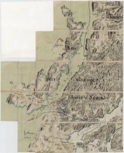
Jegerkorps nr Situationskart over en Deel af Raade, Rygge og Mosse Sogner samt Jell øen
1 : 19000 von Staffeldt | von Stabell
Portefølje nr 16
1 : 100000
deler av 14B 3 og 14B 4
1 : 25000 Vilhelm C. M. Ødegaard
14B dele af 3 og 4
1 : 25000 Ødegaard
1813-1 Horten
1 : 50000 Norges Geografiske Oppmåling
1813-1 Horten
1 : 50000 Norges geografiske oppmåling
1813-1 Horten
1 : 50000 Statens kartverk
1813-1 Horten
1 : 50000 Statens kartverk
1813-1 Horten
1 : 50000 Statens kartverk
1813-1 Horten
1 : 50000 Norges Geografiske Oppmåling