Maps of Fredrikstad

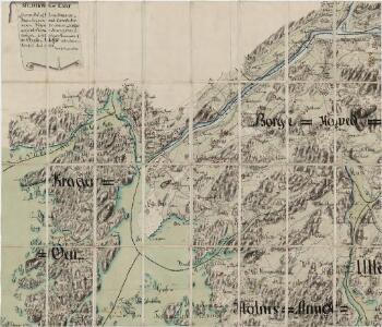
Jegerkorps nr 4-2: Situationskart over en Deel af Berg, Scheberg og Borge Sogner med tilhørende Annexer, nv
1 : 13000 von Staffeldt | von Krebs | Nøkleby
10C 5 sør
1 : 25000 Daniel Tønnesen
10C 5
1 : 20000 Ramm
10C 6 sv
1 : 25000 Harald Ingvar Johannessen
10C 5 sø
1 : 25000 Daniel Tønnesen
Mil nr 19
1 : 10000 Johan Jacob Rieck (Rick)
9D-4-Ã ̧st
1 : 10000 Theodor Johann von Wegener
Ekserserplasskart; Kroki over ekserserplassen i østre Fredrikstad og Borge med omegn
1 : 10000 Gabriel Lund
Mil nr 12
1 : 10000 Johan Jacob Rieck (Rick)
10C-1-vest
1 : 10000 Theodor Johann von Wegener
Mil nr 11
1 : 10000 von Wegener
Ekserserplasskart; Fredrikstad ekserserplass
1 : 10000
Museumskart 19: Cartt over Fridrichstds havn
1 : 5000
10C 5 nord
1 : 50000 Daniel Tønnesen
Ekserserplasskart; Fredrikstad ekserserplass
1 : 10000
Museumskart 33: Situation over Friderichstads havn
1 : 20000
Mil nr 12
1 : 10000 Johan Jacob Rieck (Rick)
10C-1-øst
1 : 10000 Theodor Johann von Wegener
10C-5-vest
1 : 10000
9D-8-Ã ̧st
1 : 10000 Theodor Johann von Wegener
Mil nr 12
1 : 10000 Johan Jacob Rieck (Rick)
Mil nr 11
1 : 10000 von Wegener
Gullbergsiden i Fredrikstad
1 : 3000 Oscar Krum Krums opmaalingskontor
Fredrikstad
1 : 50000 Nicolai Arentz Ramm | Gerhard Munthe
Kråkerøy
1 : 3000 Oscar Krum Krums opmaalingskontor
Gressvik i Fredrikstad
1 : 3000 Oscar Krum Krums opmaalingskontor
Labråten i Fredrikstad
1 : 3000 Oscar Krum Krums opmaalingskontor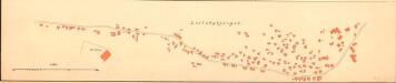
Lislebyfjellet i Fredrikstad
1 : 2000 Nicolai Solner Krum Krums opmaalingskontor
Gullbergsiden i Fredrikstad
1 : 2000 Nicolai Solner Krum Krums opmaalingskontor