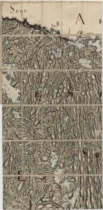
Maps of Aremark

Jegerkorps nr 19: Kart over Idd, Enningdal og Aremark sogn, del 4 vestre del
1 : 13330 Jean Henri Spørck
Mil nr 9
1 : 10000
Mil nr 15
1 : 10000 Johan Jacob Rieck (Rick)
10C-4-vest
1 : 10000 Theodor Johann von Wegener
2013-3 Aspern
1 : 50000 Norges Geografiske Oppmåling
2013-3 Aspern
1 : 50000 Norges Geografiske Oppmåling
10D 1
1 : 20000 Jacob Friderich Schilling
10C 4
1 : 50000 Collin
Jegerkorps nr 19: Kart over Idd, Enningdal og Aremark sogn, del 4 østre del
1 : 13330 Jean Henri Spørck
Mil nr 9
1 : 10000
Jegerkorps nr 21- Kart over en del av Aremark, Asak og Ødemark, den østlige del av Rakkestad, Eidsberg og Røddenæs, østre del
1 : 13330
Mil nr 15
1 : 10000 Johan Jacob Rieck (Rick)
10C-4-øst
1 : 10000 Theodor Johann von Wegener
10C 4
1 : 50000 Finn Abrahamson | Georg Peter Leganger Mamen
10A 12 nord
1 : 50000 Arve Staxrud
2013-3 Aspern
1 : 50000 Norges Geografiske Oppmåling
2013-3 Aspern
1 : 50000 Statens kartverk
2013-3 Aspern
1 : 50000 Statens kartverk
2013-3 Aspern
1 : 50000 Statens kartverk
H37 Halden
1 : 50000
NRA GA 1
Marelius | Thodal | Friedenreich | Bautz | Holm | Ratkind
Kartblad 1-2: Vei-Cart over det Iddeske Compagnie District, versjon 2
Schielderup
10A 12 sør
1 : 50000 David Ebbesen | Bent Eskildssøn Bentzen
Spesielle kart 104-4: Kart over Fredrikshaldsvassdraget med Mangenvassdraget
1 : 50000 Finn Qvale
10B 5; 10B 9
1 : 50000 David Ebbesen | Oluf Gabriel Lund
Kartblad 5- Cart over det Westre Rachestadske Compagnie; versjon 1
A. Blichfeldt
Kartblad 5-2: Cart over det Westre Rachestadske Compagnie; versjon 2
A. Blichfeldt
Jegerkorps nr 22: Kart over Bergs sogn og en del av Aremark, østre del
1 : 10000
10A 8
1 : 50000 Henrik August Angell