Maps of Stange

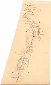
Fra Kollovangen til Løken
1 : 20000 J. H. Reichborn
H32-1; H32-2
1 : 50000 Andreas Theodor Walle
26A 7
1 : 50000 Grimsoth
26A 7 n
1 : 50000
26A 7
1 : 20000 Jørgen Scielderup Grimseth
26A 3
1 : 20000 Jørgen Scielderup Grimseth
H32-1; H32-2
1 : 50000 Andreas Theodor Walle
Kartblad 48: Militair Cart over det Stangeske Compagnie District
Falck
Geologiske kart 26: Den geologiske Undersøgelse, Hamar
1 : 100000 M. Irgens | P. Krohn | Alfred Getz | F. Jacobsen | J. Vogt | Theodor Kjerulf Norges geologiske undersøkelse
26A Hamar
1 : 100000 F. Jacobsen | C. Pedersen
26A Hamar
1 : 100000
26A Hamar
1 : 100000 Ole Engh | F. Jacobsen
26A Hamar
1 : 100000 F. Jacobsen | Ole Engh
26A Hamar
1 : 100000 Ole Engh | F. Jacobsen
26A Hamar
1 : 100000 F. Jacobsen | Ole Engh
26A Hamar
1 : 100000
1916-1 Löten
1 : 50000 Norges Geografiske Oppmåling
1916-2 Tangen
1 : 50000 Norges Geografiske Oppmåling
1916-2 Tangen
1 : 50000 Norges Geografiske Oppmåling
1916-2 Tangen
1 : 50000 Norges Geografiske Oppmåling
1916-2 Tangen
1 : 50000 Statens kartverk
1916-2 Tangen
1 : 50000 Statens kartverk
1916-2 Tangen
1 : 50000 Statens kartverk
Kartblad 49b: Geographisk Charte over Conturen af det Leuthenske mig Allernaadigst anbetroede Compagnie
Rick
26A 3
1 : 50000 Frithjof Jacobsen
Kartblad V: Vei-kaart over den trondhjemske Kongevei fra Christiania til Røraas gjennom Eidsvold, Rommedal, Levthen og Østerdalen
1 : 20000 J. H. Reichborn
Fra Korsøgarden til Nøkleby
1 : 20000 J. H. Reichborn
Fra Harstad til Frogner
1 : 20000 J. H. Reichborn
Kartblad nr 1: Kaart over Postveien fra Korsødegaarden til Trondhjem igjennom Gulbrandsdalen over Dovrefjeld
1 : 20000 J. H. Reichborn