Maps of Sørum
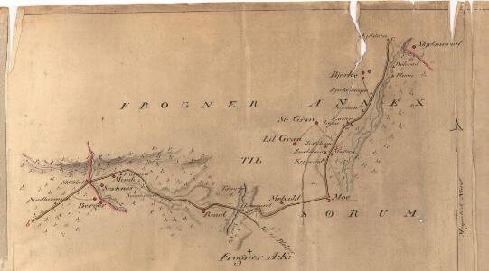
Fra Berger til Skjelmerud
1 : 20000 J. H. Reichborn
20A 2
1 : 20000
Jegerkorps nr 12A: Kart over Aker, Enebak, Nittedal, Skedsmo og Lørenskog, øst
1 : 13000 von Krebs | Ulven
Mil nr 84-bilag

Kartblad II: Vei-kaart over den trondhjemske Kongevei fra Christiania til Røraas gjennom Eidsvold, Rommedal, Levthen og Østerdalen
1 : 20000 J. H. Reichborn
Fra Fløgstad til Smedstua
1 : 20000 J. H. Reichborn
20A 2 sø/8
1 : 10000
Fra Kløfta til Vårum
1 : 20000 J. H. Reichborn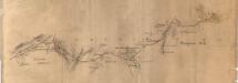
Fra Bånkallenga til Skedsmo kirke
1 : 20000 J. H. Reichborn
Mil nr 74
1 : 10000 Stochfleth junior
15C 10 nø
1 : 10000 Stockfleth
Akershus amt nr 116-5b: Terrenget omkring Ullensaker
1 : 20000 Christophersen
G35-11
1 : 50000 N. Houge
Ekserserplasskart; Gardermoen sydlig blad
1 : 50000
1915-3 Nannestad
1 : 50000 Statens kartverk
1915-3 Nannestad
1 : 50000 Statens kartverk
Kartblad 24: Wei-Kaart over det Schijedsmoiske Compagnie District
Lihme senior
20A Nannestad
1 : 100000 Johan Ferdinand Nordmann | Ole Engh
20A Nannestad
1 : 100000 Johan Ferdinand Normann | Carl Christian Olberg
20A Nannestad
1 : 100000 Johan Ferdinand Normann | Carl Christian Olberg
1915-2 Ullensaker
1 : 50000 Statens kartverk
Kartblad 42: Vej-Cort over det Ullensagerske Compagnies District (Under Norske Jægerkorps)
C. Hals
Trigonometrisk grunnlag, vedlegg 58
1 : 50000
Spesielle kart 108: à ̃versigtsprofil. Nordbanen-Lillestrà ̧m-Smaalensbanen
1 : 100000
20A Nannestad
1 : 100000 Johan Ferdinand Normann | Carl Christian Olberg
20A Nannestad
1 : 100000 Carl Christian Olberg | Johan Ferdinand Normann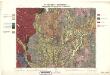
Geologiske kart 30: Den geologiske Undersøgelse, Nannestad
1 : 100000 T. Ch. Thomassen | Normann | Johan H. L. Vogt Norges geologiske undersøkelse
Finmarkens amt 54-2: HÃ¥ndtegnet kopi av kart over Ã...rdalstangen
1 : 200000 Fredrik Rode, Gerhard Munthe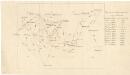
Trigonometrisk grunnlag, vedlegg 59
1 : 50000