Maps of Lillehammer

Fra Freng til Dallerud
1 : 20000 J. H. Reichborn
Kartblad nr 3: Kaart over Postveien fra Korsødegaarden til Trondhjem igjennom Gulbrandsdalen over Dovrefjeld
1 : 20000 J. H. Reichborn
25D 7
1 : 20000 Collin
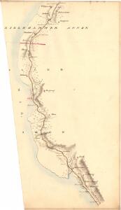
Fra Bjørnstad til Rinddal
J. H. Reichborn
G31-2; G31-3
1 : 40000 Alf Hattestad
25D 7
1 : 50000 Wilhelm Sørensen
25D 7
1 : 50000 Wilhelm Sørensen
Kartblad 4: Kart over Veien fra Eidsvold til Gausdal og til Skydsstationen Holmen i Øyer
J. H. Reichborn
25D 8
1 : 50000 Hans Christian Smith Due
Fra Honne til Fegring
J. H. Reichborn
25D 8
1 : 50000 Hans Christian Smith Due
25D 8
1 : 20000 O. Lund | Collin
25D 3; 25D 4; 25D 7; 25D 8
1 : 50000 Schilling
1817-2 Lillehammer
1 : 50000 Norges Geografiske Oppmåling
25D Lillehammer
1 : 100000
1817-2 Lillehammer
1 : 50000 Statens kartverk
Kartblad 5 Vey-Cart over det Nordre Hedemarkiske Capt. Von Weyhes Compagnie District
Johan Henrik Ramm
1817-2 Lillehammer
1 : 50000 Statens kartverk
1817-2 Lillehammer
1 : 50000 Statens kartverk
25D Lillehammer
1 : 100000
Kartblad 62: Charte over det Faabergske Compagnie District

25D Lillehammer
1 : 100000 Johan Ferdinand Normann | Ole Engh
25D Lillehammer
1 : 100000 Johan Ferdinand Normann
25D Lillehammer
1 : 100000 Einar Sigurd Ween | Johan Ferdinand Normann
25D Lillehammer
1 : 100000 Johan Ferdinand Normann
1817-2 Lillehammer
1 : 50000 Norges Geografiske Oppmåling
1817-2 Lillehammer
1 : 50000 Statens kartverk
1817-2 Lillehammer
1 : 50000 Norges Geografiske Oppmåling
1817-2 Lillehammer
1 : 50000 Statens kartverk