Maps of Melhus

Fra Støren hovedkirke til Krokstad
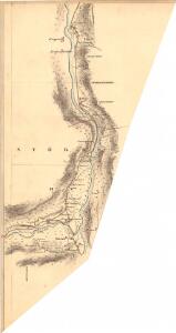
1 : 20000 J. H. Reichborn
Kartblad nr 2b: Kaart over Postveien fra Trondheim til Røraas
1 : 20000 J. H. Reichborn
42D-11-nv
1 : 10000 Køppen
42D-11-nv
1 : 10000 Køppen
42D-11-nv
1 : 10000 Køppen
42D-11-nø
1 : 10000 Hansen
42D-11-nø
1 : 10000 Hansen
42D-11-nø
1 : 10000 Hansen
1621-3 Stören
1 : 50000 Norges Geografiske Oppmåling
46B 3; 46B 4; 46B 7; 46B 8
1 : 50000 Fredrik Christian Sejersted
1621-3 Støren
1 : 50000 Statens kartverk
1621-3 Stören
1 : 50000 Norges Geografiske Oppmåling
1621-3 Støren
1 : 50000 Statens kartverk
1621-3 Støren
1 : 50000 Statens kartverk
46B Melhus
1 : 100000
46B Melhus
1 : 100000 C. Pedersen | Arnt Magnus Andreassen Øgaard
46B Melhus
1 : 100000 C. Pedersen | Arnt Magnus Andreassen Øgaard
46B Melhus
1 : 100000 C. Pedersen | Arnt Magnus Andreassen Øgaard
46B Melhus
1 : 100000
46B Melhus
1 : 100000 C. Pedersen | Arnt Magnus Andreassen Øgaard
46B Melhus
1 : 100000
46B Melhus
1 : 100000 Arnt Magnus Andreassen Øgaard | C. Pedersen
46B Melhus
1 : 100000 C. Pedersen | Arnt Magnus Andreassen Øgaard
42D 7; 42D 8; 42D 11; 42D 12
1 : 50000
46B 1; 46B 2; 46B 5; 46B 6
1 : 50000 Fredrik Christian Sejersted
Fra Kjellen til Folstad
1 : 20000 J. H. Reichborn
Fra Løklia til Gunhildsøya
1 : 20000 J. H. Reichborn
Kartblad nr 3b: Kaart over Postveien fra Trondheim til Røraas
1 : 20000 J. H. Reichborn
Fra Hovin til Fornes
1 : 20000 J. H. Reichborn