Maps of Stange

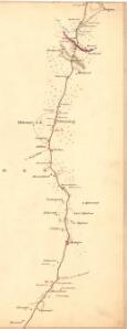
Fra Harstad til Frogner
1 : 20000 J. H. Reichborn
Hedemarkens amt nr 59b: Kart over Stange St. med omgivelser
1 : 2000 Nicolai Solner Krum
26A 6
1 : 50000 Hans Knagenhjelm Hertzberg | Jacob Ager Laurantzon
26A 6
1 : 50000 Schinstad | Collin
26A 7 n
1 : 50000
26A 6 øst
1 : 20000 Svend Stenersen Collin
26A 7
1 : 50000 Grimsoth
26A 7
1 : 20000 Jørgen Scielderup Grimseth
1916-1 Löten
1 : 50000 Norges Geografiske Oppmåling
Kartblad 48: Militair Cart over det Stangeske Compagnie District
Falck
26A 1; 26A 2; 26A 5; 26A 6; 26A 9; 26A 10
1 : 50000 Frithjof Jacobsen
Trigonometrisk grunnlag, vedlegg 46
1 : 100000
1916-2 Tangen
1 : 50000 Norges Geografiske Oppmåling
1916-1 Löten
1 : 50000 Statens kartverk
1916-2 Tangen
1 : 50000 Norges Geografiske Oppmåling
1916-2 Tangen
1 : 50000 Norges Geografiske Oppmåling
1916-1 Løten
1 : 50000 Statens kartverk
1916-2 Tangen
1 : 50000 Statens kartverk
1916-2 Tangen
1 : 50000 Statens kartverk
1916-2 Tangen
1 : 50000 Statens kartverk
1916-1 Löten
1 : 50000 Norges Geografiske Oppmåling
1916-1 Løten
1 : 50000 Statens kartverk
1916-1 Løten
1 : 50000 Statens kartverk
H32-1; H32-2
1 : 50000 Andreas Theodor Walle
H32-1; H32-2
1 : 50000 Andreas Theodor Walle
Fra Kollovangen til Løken
1 : 20000 J. H. Reichborn
26A 2
1 : 20000 Trygve Frivold Graff-Wang | Jacob Hvinden Haug
Furnes kirke til Vang kirke
1 : 20000 J. H. Reichborn
Kartblad V: Vei-kaart over den trondhjemske Kongevei fra Christiania til Røraas gjennom Eidsvold, Rommedal, Levthen og Østerdalen
1 : 20000 J. H. Reichborn