Maps of Stange

Kartblad nr 1: Kaart over Postveien fra Korsødegaarden til Trondhjem igjennom Gulbrandsdalen over Dovrefjeld
1 : 20000 J. H. Reichborn
Fra Korsøgarden til Nøkleby
1 : 20000 J. H. Reichborn
26A 3
1 : 50000 Frithjof Jacobsen
26A 3
1 : 20000 Jørgen Scielderup Grimseth
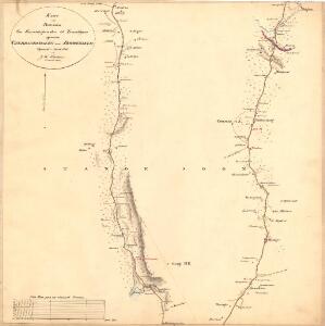
Kartblad IV: Vei-kaart over den trondhjemske Kongevei fra Christiania til Røraas gjennom Eidsvold, Rommedal, Levthen og Østerdalen
1 : 20000 J. H. Reichborn
Fra Skrepperud til Håkårud
1 : 20000 J. H. Reichborn
1916-2 Tangen
1 : 50000 Statens kartverk
1916-2 Tangen
1 : 50000 Norges Geografiske Oppmåling
1916-2 Tangen
1 : 50000 Statens kartverk
1916-2 Tangen
1 : 50000 Statens kartverk
1916-2 Tangen
1 : 50000 Norges Geografiske Oppmåling
1916-2 Tangen
1 : 50000 Norges Geografiske Oppmåling
Kartblad 48: Militair Cart over det Stangeske Compagnie District
Falck
H32-1; H32-2
1 : 50000 Andreas Theodor Walle
26A 2
1 : 20000 Trygve Frivold Graff-Wang | Jacob Hvinden Haug
H32-1; H32-2
1 : 50000 Andreas Theodor Walle
26A 2
1 : 50000 Frithjof Jacobsen
Fra Kollovangen til Løken
1 : 20000 J. H. Reichborn
26A 2
1 : 20000 Jørgen Scielderup Grimseth
Geologiske kart 26: Den geologiske Undersøgelse, Hamar
1 : 100000 M. Irgens | P. Krohn | Alfred Getz | F. Jacobsen | J. Vogt | Theodor Kjerulf Norges geologiske undersøkelse
26A Hamar
1 : 100000 F. Jacobsen | C. Pedersen
26A Hamar
1 : 100000
26A Hamar
1 : 100000 Ole Engh | F. Jacobsen
26A Hamar
1 : 100000 F. Jacobsen | Ole Engh
26A Hamar
1 : 100000 Ole Engh | F. Jacobsen
26A Hamar
1 : 100000 F. Jacobsen | Ole Engh
26A Hamar
1 : 100000
26A Hamar
1 : 100000 F. Jacobsen
Kartblad 49: Militairisk Cart over det Leuthenske Compagnie District
Jens Jacobsen Jentoft