Maps of Midtre Gauldal

Fra Løklia til Gunhildsøya
1 : 20000 J. H. Reichborn
Kartblad nr 14 og 3: Kaart over Postveien fra Korsødegaarden til Trondhjem igjennom Gulbrandsdalen over Dovrefjeld
1 : 20000 J. H. Reichborn
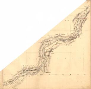
42D-11-sv
1 : 10000 Køppen
42D-11-sv
1 : 10000 Køppen
42D-11-nv
1 : 10000 Køppen
42D-11-nv
1 : 10000 Køppen
42D-11-nv
1 : 10000 Køppen
42D 6; 42D 10
1 : 50000 Birger Hielm
Kartblad nr 2b: Kaart over Postveien fra Trondheim til Røraas
1 : 20000 J. H. Reichborn
42D Rennebu
1 : 100000 Torgrim Lundtvedt | Ole Engh
42D Rennebu
1 : 100000 Torgrim Lundtvedt | Nicolai Franck
42D Rennebu
1 : 100000 Torgrim Lundtvedt | Nicolai Franck
42D Rennebu
1 : 100000
42D Rennebu
1 : 100000
42D Rennebu
1 : 100000 Ole Engh | Torgrim Lundtvedt
42D Rennebu
1 : 100000
Kartblad 105: Carte over det Størenske Compagnie District
Peter Laurentius Sidelmann Sigholdt
46B 1; 46B 2; 46B 3; 46B 4; 46B 5; 46B 6; 46B 7; 46B 8
1 : 50000 Fredrik Christian Sejersted
1520-1 Rennebu
1 : 50000 Statens kartverk
Kartblad 106: Carte over det Renneboiske Compagnie District

1520-1 Rennebu
1 : 50000 Norges Geografiske Oppmåling
1520-1 Rennebu
1 : 50000 Statens kartverk
1521-2 Orkland
1 : 50000 Norges Geografiske Oppmåling
42D 7; 42D 8; 42D 11; 42D 12
1 : 50000
1521-2 Hølonda
1 : 50000 Statens kartverk
1521-2 Hølonda
1 : 50000 Statens kartverk
1520-1 Rennebu
1 : 50000 Statens kartverk
1520-1 Rennebu
1 : 50000 Norges Geografiske Oppmåling
1620-4 Budal
1 : 50000 Statens kartverk