Maps of Røst

Museumskart 14 Hav området utenfor kysten mellom Tranøy og Gisund
1 : 50000
Røst
1 : 250000 O. Engh | E. Daarstad
Røst
1 : 250000 E. Daarstad | O. Engh
Røst
1 : 250000 E. Daarstad | O. Engh
Røst
1 : 250000 E. Daarstad | O. Engh
Trigonometrisk grunnlag, vedlegg 68b: Kart over de trigonometriske Hovednet
1 : 500000
Spesielle kart 154-3: Nattflykart, blad 3
1 : 500000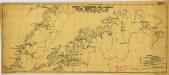
Norway-Aerodromes and possible sites North of Lat,65 (1940)
Norway-Aerodromes and possible sites North of Lat,65 [compiled from information supplied up to 16th May 1940], ADI (Maps) AM 33W. [S.l.] : Air Ministry, United Kingdom
Statistikk 43-21- Bosettingskart over Bodø. Blad 21
1 : 250000 Statistisk Sentralbyrå
Statistikk 43-21-2: Bosettingskart over Bodø. Blad 21
1 : 250000 Statistisk Sentralbyrå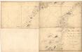
Museumskart 138: Kart over Den norske kyst fra Fleina og Sandhornet til Tranø med den sydlige deel af Lofoten
1 : 200000 Vibe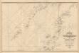
Museumskart 217-13: Kart over den Norske Kyst fra Fleina og Sandhornet til Tranø
1 : 50000 Vibe | Due | Rynning | G. L. Fehr | Broch Opmaalings Directionen
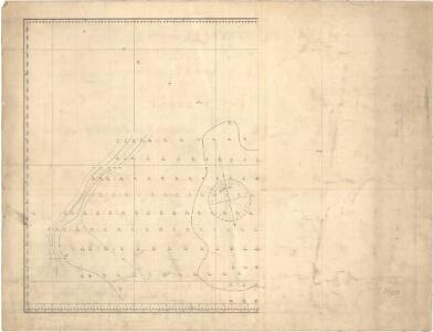
Moskenesøy
1 : 250000 O. Engh | Scott Ruud
1729-1 Røst
1 : 50000 Statens kartverk
1729-1 Røst
1 : 50000 Statens kartverk
1729-1 Skomvær
1 : 50000 Norges Geografiske Oppmåling
Trigonometrisk grunnlag, vedlegg 67
1 : 500000 Vibe
Spesielle kart 63: Pflanzengeographische Karte Über Das Königreich Norwegen, blad 3
1 : 1000000 F. C. Schübeler
Museumskart 127: Kart over Den norske kyst fra Trondhjems leden til Tromsø
1 : 200000 Vibe
Spesielle kart 101-2: Postkart over det nordlige Norge
1 : 1000000 K. Gleditsch
Spesielle kart 89-2: Rikstelegrafens og private telefonselskapers linjeruter i det nordlige Norge
Ukjent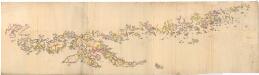
Museumskart 129: Nordlandene
1 : 200000 Hautz
Museumskart 217- Kart over Den norske Kyst fra Trondhjems leden til Tromsø
1 : 350000 Vibe | G. L. Fehr G. L. Fehr lith Inst. Christiania
Spesielle kart 18 Nord-vest: Telegrafkart over Norge
1 : 1000000 Den Private Opmaaling, Kristiania
Spesielle kart 42-1: Rigstelegraf- og Telefonkart over det nordlige Norge
1 : 800000
Feuille 10 (C II), uit: Carte géologique internationale de l'Europe : la carte, votée au congrès géologique international de Bologne en 1881, est exécutée conformément aux décisions d'une commission internationale, avec le concours des gouvernements, sous le dir. de M.M. Beyrich et Hauchecorne
Annotatie: Blad 48 gamme des couleurs; blad 49: bladwijzer en titelblad Heinrich Ernst Beyrich 1815-1896; Wi. Hauchecorne Berlin : Reimer / (Berlin: Institut lithographique)
Spesielle kart 64: Norvège Carte Zoo-Géographique, blad 1
1 : 2400000 Robert Collett
Spesielle kart 65-3: Oversigtskart over de paa den norske Kyst anbragte Fyre
1 : 1000000
Statistikk kart 6 nord: Norvége. Densité de la population en 1865
1 : 1000000