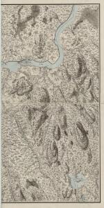
Maps of Sør-Odal

Mil nr 97
1 : 10000 Ditlef Wibe
20A 8 sø
1 : 10000 Peter Myhre | Hans Frederich Tambs
20A 8 nø
1 : 10000 Hans Frederich Tambs | Peter Myhre
20A 8 sø
1 : 10000 Peter Myhre | Hans Frederich Tambs
20A 8 nø
1 : 10000
20A 8 nø
1 : 10000 Peter Myhre | Hans Frederich Tambs
20A 8 sør
1 : 10000 Peter Myhre | Hans Frederich Tambs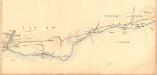
Fra Oppåker til Ullern kirke
1 : 20000 J. H. Reichborn
2015-3 Strøm
1 : 50000 Statens kartverk
2015-3 Funnefoss
1 : 50000 Statens kartverk
2015-3 Ström
1 : 50000 Norges Geografiske Oppmåling
2015-3 Ström
1 : 50000 Norges Geografiske Oppmåling
2015-3 Ström
1 : 50000 Norges Geografiske Oppmåling
2015-3 Funnefoss
1 : 50000 Statens kartverk
2015-3 Strøm
1 : 50000
Trigonometrisk grunnlag, vedlegg 15: Fundament Mensul for Sammenbindelsen af de gamle Operationer
1 : 50000 Hans Lemich Juell | Johan Henrik Ramm
2015-3 Ström
1 : 50000 Statens kartverk
Mil nr 86
1 : 10000 O. von Gedde
20B 5
1 : 50000 Johannes Solem
20A 4 nø og 20A 8 sv
1 : 10000
Mil nr 98
1 : 10000 Johan Henrich Ramm
20B 5 vest
1 : 10000 Niels Stockfleth Darre
20B 5 sv
1 : 10000 Ramm | Niels Stockfleth Darre
20A 12 sørøstre del, versjon 2
1 : 10000
20A 12 sørøstre del, versjon 1
1 : 10000 Hans Frederich Tambs
20B 5 nv
1 : 10000 Ramm | Niels Stockfleth Darre
Trigonometrisk grunnlag, vedlegg 22: Kvadratmilien No 97, kvadratmilen No 58
1 : 10000
20A Nannestad
1 : 100000 Johan Ferdinand Normann | Carl Christian Olberg
20A Nannestad
1 : 100000 Johan Ferdinand Normann | Carl Christian Olberg