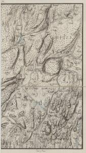
Maps of Vestby

Mil nr 39
1 : 10000 Ramm
14B 8 sø
1 : 25000 Vilhelm C. M. Ødegaard
14B 8 nø
1 : 25000 Vilhelm C. M. Ødegaard
Jegerkorps nr 11A: Kart over Aas, Krogstad, Vestby, Hob og Vaaler, øst
1 : 13000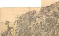
14B-8
1 : 10000 Gustav Adolph von Wahrendorff
14B 8
1 : 20000 Hans Øvergaard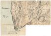
14B-8
1 : 10000 Gustav Adolph von Wahrendorff
Trigonometrisk grunnlag, vedlegg 12: Fundament Mensul til Deel af Qvadrat-Miilen Nomer 39
1 : 20000 Hans Lemmich Juell | Carl Wendel Bremer
14B 8 nv
1 : 25000 Vilhelm C. M. Ødegaard
Jegerkorps nr 5- Kart over Onsø, Gleminge, Thunø, Raade, Rygge, en del av Vaaler, Svindal, Skibtvedt, Moss og Vassbygden, Jeløen og Soner, øst
1 : 13000
14B 8 sør
1 : 25000 Vilhelm C. M. Ødegaard
Mil nr 32
1 : 10000 Carl Alexander Stricker
14B 12 sø
1 : 25000 Karl A. Egeberg
Mil nr 40
1 : 10000 Hans Lemmich Juell | Ramm | Gustav Adolph von Wahrendorff
1914-3 Ski
1 : 50000 Norges Geografiske Oppmåling
1914-3 Ski
1 : 50000 Statens kartverk
1914-3 Ski
1 : 50000 Norges Geografiske Oppmåling
1914-3 Ski
1 : 50000 Statens kartverk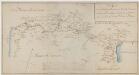
Kartblad 11- Wey-Cart over det Haabbelske Compagnie District, versjon 1

1914-3 Ski
1 : 50000 Norges Geografiske Oppmåling
1914-3 Ski
1 : 50000 Statens kartverk
1914-3 Ski
1 : 50000 Statens kartverk
1914-3 Ski
1 : 50000 Statens kartverk
Portefølje nr 16
1 : 100000
Kartblad 35: Veikaart over det Søndre Follougske Compagnie District
Larsen
Jegerkorps nr 11B: Kart over Aas, Krogstad, Vestby, Hob og Vaaler, vest
1 : 13000
14B 4 nord
1 : 25000 Vilhelm C. M. Ødegaard
15A 5 b
1 : 40000 H. Hansen | H. Øvergaard
15A 5 a
1 : 40000 H. Øvergaard | H. Hansen