Maps of Årjängs kommun

Mil nr 23
1 : 10000 Stochfleth
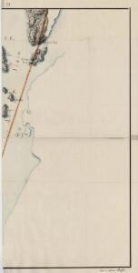
10D-5-øst
1 : 10000 Theodor Johann von Wegener
10D 6
1 : 20000 Jacob Friderich Schilling
10D 10
1 : 20000 Ramm
Mil nr 23
1 : 10000 Stochfleth
10D-5-vest
1 : 10000 Theodor Johann von Wegener
Jegerkorps nr 17: Kart over Aremark og en del av Ødemark anneks
1 : 10000 von Stabell | von Staffeldt
Jegerkorps nr 21-3: Kart over Aremark, Ødemark og Røddenæs
1 : 13330
Jegerkorps nr 20-4: Kart over Aremark, Ødemark og Røddenæs
1 : 13330
10D Aremark
1 : 100000
10D Aremark
1 : 100000 H. C. Wanggård | Anton Dellinger
NRA GA 1
Marelius | Thodal | Friedenreich | Bautz | Holm | Ratkind
Kartblad 3-2: Vey-Kart over det Markerske Compagnie District; versjon 2
Rode
Kartblad 1-2: Vei-Cart over det Iddeske Compagnie District, versjon 2
Schielderup
Kartblad 1- Vei-Cart over det Iddeske Compagnie District; versjon 1
Schielderup
Spesielle kart 104-4: Kart over Fredrikshaldsvassdraget med Mangenvassdraget
1 : 50000 Finn Qvale
2013-4 Øymark
1 : 50000 Statens kartverk
2013-4 Øymark
1 : 50000 Statens kartverk
2013-4 Öymark
1 : 50000 Norges Geografiske Oppmåling
H37 Halden
1 : 50000
Kartblad 3- Vey-Kart over det Markerske Compagnie District; versjon 1
Rode
10D Aremark
1 : 100000 Einar Sigurd Ween | Anton Dellinger
10C 12
1 : 50000 Karl Fredrik Kase
10D 5
1 : 20000 Jacob Friderich Schilling
2013-4 Öymark
1 : 50000 Norges Geografiske Oppmåling
2013-4 Öymark
1 : 50000 Norges Geografiske Oppmåling
10D 9
1 : 20000 Ramm
10D-1
1 : 10000 Theodor Johann von Wegener
Mil nr 16
1 : 10000 Johan Jacob Rieck (Rick)