Maps of Fredrikstad

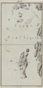
Mil nr 17
1 : 10000 Johan Jacob Rieck (Rick)
9D-7
1 : 10000 Theodor Johann von Wegener
9D 8
1 : 20000 JÃ ̧rgen Scielderup Grimseth
9D 8
1 : 25000 Thomas Georg Backer
Portefølje nr 16
1 : 100000
Kartblad 8-2: Militairisk Kart over det Onsøeske Compagnie District; versjon 2

Kartblad 8- Militairisk Kart over det Onsøeske Compagnie District; versjon 1

Jegerkorps nr 5-3: Kart over Onsø, Gleminge, Thunø, Raade, Rygge, en del av Vaaler, Svindal, Skibtvedt, Moss og Vassbygden, Jeløen og Soner, vest
1 : 13000
1813-1 Horten
1 : 50000 Norges Geografiske Oppmåling
1813-1 Horten
1 : 50000 Norges geografiske oppmåling
1813-1 Horten
1 : 50000 Statens kartverk
1813-1 Horten
1 : 50000 Statens kartverk
1813-1 Horten
1 : 50000 Statens kartverk
9D 12
1 : 20000 JÃ ̧rgen Scielderup Grimseth
9D 12 sv 9D 12 nv 9D 12 nà ̧
1 : 25000 Carl Axel Sigurd Sissener
Jegerkorps nr 5-2: Kart over Onsø, Gleminge, Thunø, Raade, Rygge, en del av Vaaler, Svindal, Skibtvedt, Moss og Vassbygden, Jeløen og Soner
1 : 13000
9D 7
1 : 50000
Mil nr 18
1 : 10000 Ulrich Anton Nicolai Blix Aamodt
Mil nr 11
1 : 10000 von Wegener
Mil nr 24
1 : 10000 Johan Jacob Rieck (Rick)
9D-11
1 : 10000 Gustav Adolph von Warendorf
9D 12 sà ̧
1 : 25000 Finn Abrahamson
9D-8-vest
1 : 10000 Theodor Johann von Wegener
Museumskart 217-45: Specialkart over Kristianiafjorden fra Bastø til Lille Færder
1 : 50000 C. F. Wille | G. Jacobsen Den Geografiske Opmaaling
9D Tønsberg
1 : 100000 Carl Christian Olberg | Ole Tolstad
9D Tønsberg
1 : 100000 Ole Tolstad | Carl Christian Olberg
Geologisk kart 9: Den geologiske undersøgelse, Rektangel 9D Tønsberg
1 : 100000 M. T. Kingo | M. Bugge | A. Dellinger Norges geologiske undersøkelse
9D Tønsberg
1 : 100000 Ole Tolstad | C. Pedersen
9D Tønsberg
1 : 100000