Maps of Porsanki

2035-2 Holmvatnet
1 : 50000 Norges Geografiske Oppmåling
2035-2 Muŋ'kavarri
1 : 50000 Norges Geografiske Oppmåling
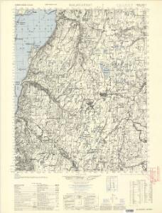
2035-2 Muŋ'kavarri
1 : 50000 Statens kartverk
2035-2 Muŋ'kavarri
1 : 50000 Statens kartverk
W4 sørvestre del
1 : 50000 Oskar Jakob Nikolai Rieck | Sigurd Sandvik | Toralf Øyen
W4 Børselv
1 : 100000
W4 Børselv
1 : 100000
W4 Børselv
1 : 100000
W4 Børselv
1 : 100000
W4 Børselv
1 : 100000
W4 nordvestre del
1 : 50000 Hans Finne | Hans Knagenhjelm Hertzberg | Thorolf Ingar Ween
W4 søndre del
1 : 50000 Oskar Jakob Nikolai Rieck | Thorleif Barlag | Otto Ruge
W4 sørøstre del
1 : 50000 Otto Ruge
W4 Børselv
1 : 100000
W4 Børselv
1 : 100000
V4 Stabbursdalen
1 : 100000
V4
1 : 100000 Thorleif Barlag
V4 nordre del; V3 2 og 3
1 : 100000 Per Tang
V4 Stabbursdalen
1 : 100000
2035-3 Lakselv
1 : 50000 Norges Geografiske Oppmåling
2135-3 Ræt'kajåkskai'di
1 : 50000 Statens kartverk
2035-3 Lakselv
1 : 50000 Statens kartverk
W4 nordøstre del
1 : 50000 Thorolf Ingar Ween
W4 nordøstre del
1 : 50000 Hans Finne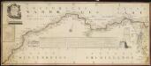
NRA GA 23
Wetterstedt | Thodal | Halldin | Krogh | Wessaman | Holm
Finmarkens amt nr 6: Situations Kort over Finmarken og dens Grændser
1 : 600000 H. J. Broch
Statistikk 43-31-2: Bosettingskart over Honningsvåg. Blad 31
1 : 250000 Statistisk Sentralbyrå
Statistikk 43-31- Bosettingskart over Honningsvåg. Blad 31
1 : 250000 Statistisk Sentralbyrå
Museumskart 144: Kart over Den Norske Kyst fra Sørøen til Nordkap
1 : 200000 Klouman | Hagerup | Due | Vibe | Rynning