Maps of Guovdageaidnu

1932-1 Niei'davarri
1 : 50000 Statens kartverk
1932-1 Niei'davarri
1 : 50000 Norges Geografiske Oppmåling
1932-1 Nieidavárri
1 : 50000 Statens kartverk
1932-1 Niei'davarri
1 : 50000 Norges Geografiske Oppmåling
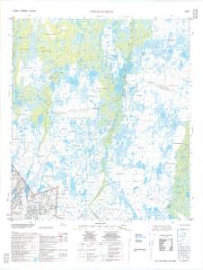
1932-1 Småhaugvatnet
1 : 50000 Norges Geografiske Oppmåling
V8 Noarvas
1 : 100000 Ole Engh | Ole Bernhard Tolstad
V8 Noarvas
1 : 100000
Spesielle kart 171-kart8: Riksgrensekart fra grenseoppgangen Norge_Finland fra Treriksrà ̧ysa til Krokfjellet
1 : 50000 Yrjö Kärkkäinen | Erik O. Dahle | Th. Sà ̧mod | Seppo Härmälä
V8
1 : 100000 Finn Qvale
Spesielle kart 172-10: Kart over riksgrensen mellom Norge og Finland
1 : 40000 K. Vaala | Gleditsch | Arvo Manner | Kristian Nissen
V8 Noarvas
1 : 100000 Ole Bernhard Tolstad | Ole Engh
V8 Noarvas
1 : 100000 Ole Bernhard Tolstad | Ole Engh
V8 Noarvas
1 : 100000 Ole Bernhard Tolstad | Ole Engh
NRA GA 21
Wessaman | Thodal | Halldin | Krogh | Holm | Wetterstedt
U8
1 : 100000 Thorleif Barlag
U8
1 : 100000 Thorleif Barlag
U8 Lavvooaivve
1 : 100000
U8 Lavvooaivve
1 : 100000 Ole Tolstad | C. Pedersen
V8 søndre del og V9 nordre del
1 : 100000 Nils Johannes Sejersted
U8
1 : 100000 Jonas Samuel Petersen
U7
1 : 100000 Thorleif Barlag
U8 Lavvooaivve
1 : 100000
U8 Lavvooaivve
1 : 100000 Ole Tolstad | C. Pedersen
V7 Bæivasgiedde
1 : 100000 Arnt Magnus Andreassen Øgaard | Einar Sigurd Ween
1933-2 Galbbajavrre
1 : 50000 Norges Geografiske Oppmåling
1933-2 Gal'bajav'ri
1 : 50000 Norges Geografiske Oppmåling
1933-2 Gal'bajav'ri
1 : 50000 Statens kartverk
U7
1 : 100000 Axel P. Printz
V7
1 : 100000 Nicolay Caspary Ræder