Maps of Lørenskog

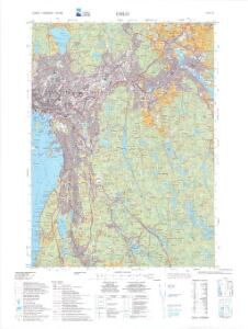
1914-4 Oslo
1 : 50000 Statens kartverk
1914-4 Oslo
1 : 50000 Norges Geografiske Oppmåling
1914-4 Oslo
1 : 50000 Norges Geografiske Oppmåling
15C 5 (geometrisk hovednet)
1 : 50000
1914-4 Oslo
1 : 50000 Statens kartverk
G35-11
1 : 50000 Niels Sire | Andreas Theodor Walle
G35-10
1 : 25000 Andreas Theodor Walle
Jegerkorps nr 12B: Kart over Aker, Enebak, Nittedal, Skedsmo og Lørenskog, vest
1 : 13000 von Krebs | Gantzer
G35-10; G35-11
1 : 50000 Gustav Adolf Tajet
15C 9 vest
1 : 25000 Johan Nicolai Hertzberg
Oslo blad 2 Nordstrand
1 : 25000 Solem | O. Engh NGO
Oslo omegn blad 2
1 : 25000 Solem | O. Engh NGO
Oslo blad 4
1 : 25000 NGO
Oslo omegn blad 4
1 : 25000 O. Engh | J. Natrud
Oslo omegn blad 4
1 : 25000 J. Natrud | O. Engh
Kristiania omegn blad 4
1 : 25000 J. Natrud | O. Engh NGO
Kristiania omegn blad 4
1 : 25000 J. Natrud | O. Engh NGO
Jegerkorps nr 12A: Kart over Aker, Enebak, Nittedal, Skedsmo og Lørenskog, vest
1 : 13000 Ulven | von Krebs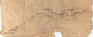
Fra Oslo domkirke til Romsås
1 : 20000 J. H. Reichborn
Kartblad I: Vei-kaart over den trondhjemske Kongevei fra Christiania til Røraas gjennom Eidsvold, Rommedal, Levthen og Østerdalen
1 : 20000 J. H. Reichborn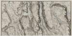
Mil nr 63
1 : 10000 Hans Lemmich Juell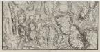
Mil nr 63
1 : 10000 Hans Lemmich Juell
15C 6 øst
1 : 10000 Niels Stockfleth Darre | Friis
15C 5 øst
1 : 10000 Hans Lemmich Juell | Carl Wendel Bremer
15C-9-øst
1 : 10000 Niels Stockfleth Darre | Friis
15C 5 nø
1 : 25000 Johannes Solem
15C-9-vest
1 : 10000 Niels Stockfleth Darre | Friis
15C 9 vest
1 : 10000 Niels Stockfleth Darre | Friis
15C 9 øst
1 : 10000 Niels Stockfleth Darre | Friis