Maps of Værøy

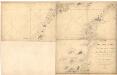
1830-3 Væröy
1 : 50000 Statens kartverk
1830-3 Værøy
1 : 50000 Statens kartverk
1830-3 Væröy
1 : 50000 Norges Geografiske Oppmåling
1830-3 Væröy
1 : 50000 Statens kartverk
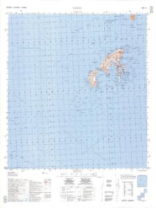
H12, I12 Røst
1 : 100000 Carl Peter Bruun | Carl Christian P. Olberg
H12, I12 Røst
1 : 100000 Carl Peter Bruun | Carl Christian P. Olberg
H12, I12 Røst
1 : 100000 Carl Peter Bruun | Carl Christian P. Olberg
I11-sør, I12-nord
1 : 50000 Haakon Schive | Carl Peter Bruun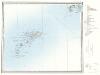
H12, I12 Røst
1 : 100000
H12, I12 Røst
1 : 100000 Carl Peter Bruun | Carl Christian P. Olberg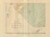
Museumskart 217-49: Fiskekart over den indre del af Vestfjorden i Lofoten
1 : 100000 M. Lyng Den Geografiske Opmaaling
H12, I12 Røst
1 : 100000 Carl Peter Bruun | Carl Christian P. Olberg
I11 Lofotodden
1 : 100000 C. Pedersen | Johan Gulbrandsen Natrud
I11 Lofotodden
1 : 100000 C. Pedersen | Johan Gulbrandsen Natrud
I11 Lofotodden
1 : 100000
I11 Lofotodden
1 : 100000
I11 Lofotodden
1 : 100000
I11 Lofotodden
1 : 100000 Johan Gulbrandsen Natrud | H. C. Wanggård
I11 Lofotodden
1 : 100000 Johan Gulbrandsen Natrud | C. Pedersen
I11 Lofotodden
1 : 100000 Johan Gulbrandsen Natrud | H. C. Wanggård
I11 Lofotodden
1 : 100000 Johan Gulbrandsen Natrud | H. C. Wanggård
I11 Lofotodden
1 : 100000 Johan Gulbrandsen Natrud | C. Pedersen
I11 Lofotodden
1 : 100000
Røst
1 : 250000 E. Daarstad | O. Engh
Geologiske kart 121-U: Kart med magnetisk totalfelt. Bodø
1 : 250000 Norges geologiske undersøkelse
Røst
1 : 250000 O. Engh | E. Daarstad
Røst
1 : 250000 E. Daarstad | O. Engh
Røst
1 : 250000 E. Daarstad | O. Engh
Statistikk 43-21-2: Bosettingskart over Bodø. Blad 21
1 : 250000 Statistisk Sentralbyrå