Maps of Namsskogan

1824-1 Namsskogan
1 : 50000 Statens kartverk
1824-1 Brekkvasselv
1 : 50000 Norges Geografiske Oppmåling
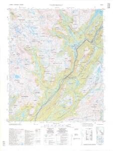
1824-1 Namsskogan
1 : 50000
1824-1 Namsskogan
1 : 50000 Statens kartverk
1824-1 Namsskogan
1 : 50000 Statens kartverk
54C 10; 54C 11
1 : 50000 Emil Adolf Eriksen
57A 1; 57A 2
1 : 50000 Jens Munthe Dahl
57A Frøiningsfjeld
1 : 100000 Johan Gulbrandsen Natrud | H. Hagen
54C Trones
1 : 100000
Geologisk kart 110: Trones
1 : 100000 Steinar Foslie Norges geologiske undersøkelse
54C Trones
1 : 100000 Johan Gulbrandsen Natrud | Johan Nordhagen
54C Trones
1 : 100000 C. Pedersen | Johan Gulbrandsen Natrud
Geologisk kart 97: Trones
1 : 100000 Steinar Foslie Norges geologiske undersøkelse
54C Trones
1 : 100000
57A Frøiningsfjeld
1 : 100000 H. Hagen | Johan Gulbrandsen Natrud
57A Frøiningsfjeld
1 : 100000 H. Hagen | Johan Gulbrandsen Natrud
57A Frøiningsfjeld
1 : 100000
57A Frøiningsfjeld
1 : 100000
57A Frøiningsfjeld
1 : 100000 H. Hagen | Johan Gulbrandsen Natrud
57A 3; 57A 4 (1/4)
1 : 50000 August Geelmuyden Spørck
57A 6; 57A 7; 57A 10; 57A 11
1 : 50000 Ole Hagbart Bertrand Norgrenn
1825-2 Majaklumpen
1 : 50000 Norges Geografiske Oppmåling
1825-2 Majafjellet
1 : 50000 Statens kartverk
1824-2 Skorovatn
1 : 50000 Statens kartverk
1825-2 Majafjellet
1 : 50000 Norges Geografiske Oppmåling
1824-2 Skorovatn
1 : 50000 Statens kartverk
57A 8
1 : 50000 August Geelmuyden Spørck
1824-2 Namskogan
1 : 50000 Norges Geografiske Oppmåling
1824-2 Skorovatn
1 : 50000 Norges Geografiske Oppmåling