Maps of Kvænangen

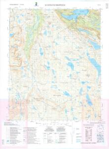
1734-2 Kvænangsbotn
1 : 50000 Statens kartverk
1734-2 Kvænangsbotn
1 : 50000 Statens kartverk
1734-2 Kvænangsbotn
1 : 50000 Statens kartverk
1734-2 Kvænangsbotn
1 : 50000 Norges Geografiske Oppmåling
Krokering nr 37
1 : 100000 Lund
Krokering nr 36
1 : 100000 Lund
Krokering nr 67
1 : 100000 Morgenstierne
Krokering nr 76
1 : 100000 Lund
Krokering nr 81
1 : 200000 Morgenstierne
T6
1 : 100000 Thorleif Barlag
T5 Kaafjord
1 : 100000 Ole Tolstad | C. Pedersen
T6 Nabar
1 : 100000
Krokering nr 16
1 : 100000 Lund
T5 Kaafjord
1 : 100000 Ole Tolstad | C. Pedersen
Krokering nr 69
1 : 100000 Morgenstierne
93A 7; 93A 8; 93A 11
1 : 100000 Carl Oscar Munthe
Krokering nr 17
1 : 100000 Lund
Geologiske kart 121-Z: Kart med magnetisk totalfelt. Nordreisa
1 : 250000 Norges geologiske undersøkelse
Statistikk 36-3 sør: Ethnigrafisk Kart over Finmarkens Amt No 3
1 : 200000 Jens Andreas Friis
Statistikk 43-27-2: Bosettingskart over Nordreisa. Blad 27
1 : 250000 Statistisk Sentralbyrå
Statistikk 43-27- Bosettingskart over Nordreisa. Blad 27
1 : 250000 Statistisk Sentralbyrå
Krokering nr 38-2
1 : 100000 Lund
Museumskart 217-16: Kart over Den Norske Kyst fra Kvalø og Grøtsund til Sørøen
1 : 50000 Due | G. L. Fehr | Rynning | Vibe | Hagerup Opmaalings Directionen
Museumskart 143: Kart over Den Norske Kyst fra Kvalø og Grøtsund til Sørøen
1 : 200000 Due | Rynning | Vibe | Hagerup
Finmarkens amt nr 53a: Kaafjord
1 : 20000 Fr. Löwenborg
Spesielle kart 122-12: Postkart over Norge
1 : 400000 Toralf à ̃yen
Statistikk 38-13: Bosettingskart over Finnmark og Troms. Blad 13
1 : 400000 Statistisk Sentralbyrå
Tysk kart over Tromsø (Deutsche Heereskarte - Europa)
1 : 500000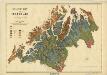
Geologisk kart 35: Geologisk kart over Tromsø Amt
1 : 400000 Karl Pettersen