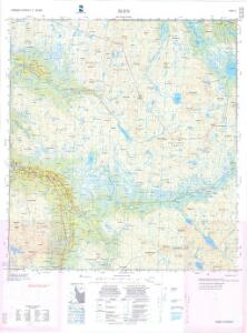
Maps of Holtålen

Maps of Holtålen

$title$

1720-4 Ålen

1 : 50000 Statens kartverk
$title$

1720-4 Ålen

1 : 50000 Statens kartverk
$title$

1720-4 Ålen

1 : 50000 Statens kartverk
$title$

1720-4 Ålen

1 : 50000 Norges Geografiske Oppmåling
$title$

1720-4 Ålen

1 : 50000 Norges Geografiske Oppmåling
$title$

43C 8

1 : 50000 Johan Lauritz Bull
$title$

Kartblad nr 5b: Kaart over Postveien fra Trondheim til Røraas

1 : 20000 J. H. Reichborn
$title$

43C 4

1 : 50000 Johan Lauritz Bull
$title$

Fra Nesvollen til Grytbakk

1 : 20000 J. H. Reichborn
$title$

43C-8-nø

1 : 10000
$title$

43C-8-sø

1 : 10000
$title$

43C 4

1 : 20000 Hegrem
$title$

43C-8-sø

1 : 10000
$title$

43C-8-nv

1 : 10000
$title$

43C-7-nø

1 : 10000 Jan Carl Feilberg
$title$

43C 7

1 : 50000 Johan Lauritz Bull
$title$

43C 12

1 : 50000 Daniel Tønnesen
$title$

43D-1-sv

1 : 10000 Tønseth | Hansen
$title$

43D 1

1 : 20000 Tønsæth | Hanssen
$title$

43C-8-sv

1 : 10000
$title$

43C-8-nv

1 : 10000
$title$

43C-8-sv

1 : 10000
$title$

43C-8-nø

1 : 10000
$title$

43C-4-nv

1 : 10000 Hegrem
$title$

43D-5-nv

1 : 10000 Jan Carl Feilberg
$title$

43D-1-nv

1 : 10000 Tønseth | Hansen
$title$

43D-5-sv

1 : 10000 Jan Carl Feilberg
$title$

43C-3-nø

1 : 10000 Mathisen
$title$

43C-7-sø

1 : 10000 Jan Carl Feilberg
$title$

43C-7-nø

1 : 10000 Jan Carl Feilberg
© MapTiler © OpenStreetMap contributors
How does it work?
These instructions will show you how to find historical maps online.
Getting started
Type the place name in the search box to find the exact location. You can further adjust the search by zooming in and out.
Zoom
Zoom in and out with the buttons or use your mouse or touchpad natively.
Exact Area tool
Click here and draw a rectangle over the map to precisely define the search area.
Set filters
Narrow your search with advanced settings, such as Years (from/to), Fulltext, Publisher, etc.
Results
See the results of your search on the right side. You can scroll down to find more maps of this location.
?

Download OldMapsOnline Mobile