Maps of Rendalen

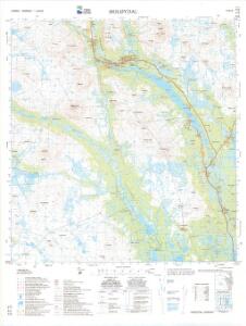
1719-3 Holøydal
1 : 50000 Statens kartverk
1719-3 Holöydal
1 : 50000 Norges Geografiske Oppmåling
1719-3 Holöydal
1 : 50000 Norges Geografiske Oppmåling
1719-3 Holøydal
1 : 50000 Statens kartverk
1719-3 Holöydal
1 : 50000 Statens kartverk
38C 4; 38C 8
1 : 50000 Georg Otto Lorange
Mil nr 305
1 : 10000 Friderich Georg Beichmann | Johan Friderich Næser
38A 12
1 : 50000 Karl Marius Leewy
38B 9 vest
1 : 10000 Friderich Georg Beichmann | Johan Friderich Næser
38B 9 nv
1 : 10000 Johan Friderich Næser | Friderich Georg Beichmann
38C 3
1 : 50000 Sigvald Hansen
38B 9 sv
1 : 10000 Friderich Georg Beichmann | Johan Friderich Næser
38C 4; 38C 8; 38D 1; 38D 5
1 : 50000 Ramm
38A 7; 38A 8; 38A 11; 38A 12
1 : 50000 Ramm
38A 7; 38A 11
1 : 50000 Thor Alexander Dahl
38B 9
1 : 50000 Bjarne Gjølme
38C 8
1 : 50000 Sigvald Hansen
38B 5
1 : 50000 Ole Sandberg Midelfart
38D 1; 38D 2
1 : 50000 Carl Peter Bruun | Haakon Schive
Mil nr 305
1 : 10000 Friderich Georg Beichmann | Johan Friderich Næser
38B 9 sø
1 : 10000 Friderich Georg Beichmann | Johan Friderich Næser
38B 9 øst
1 : 10000 Johan Friderich Næser | Friderich Georg Beichmann
Spesielle kart 103-4: Flötningskart over Glommens vassdrag
1 : 1000 Einar Sigurd Ween
Kartblad 166b-4: Wej-Cart over det Aamodske Compagnie; 166b-4

Geologisk kart 10 Tynset
1 : 100000 Per Holmsen | Gunnar Holmsen Norges geologiske undersøkelse
Spesielle kart 22-3: Tønset - Røros
1 : 400000 Albert Cammermeyer Forlag
38C Tynset
1 : 100000 C. Pedersen | Torgrim Lundtvedt
38C Tynset
1 : 100000 C. Pedersen | Torgrim Lundtvedt
Geologisk kart 77: Nordre Femund
1 : 100000 Gunnar Holmsen Norges geologiske undersøkelse