Maps of Kongsberg

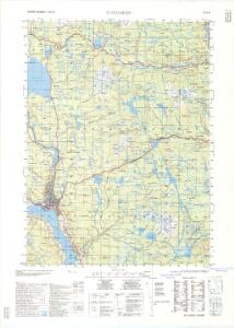
1714-3 Notodden
1 : 50000 Norges Geografiske Oppmåling
1714-3 Notodden
1 : 50000 Norges Geografiske Oppmåling
1714-3 Notodden
1 : 50000 Statens kartverk
1714-3 Notodden
1 : 50000 Statens kartverk
14A 10
1 : 50000 Wilhelm Ernst Ramm Gran | Birch
14A 9
1 : 50000 A. Boyesen | Wilhelm Ernst Ramm Gran
14C 1
1 : 50000 Birch
14A 5
1 : 50000 Lars Marius Bing Broch | Frithjof Jacobsen
1714-3 Notodden
1 : 50000 Statens kartverk
Geologiske kart 2: Kart over Kongsberg Ertsdistrikt
1 : 60000 Dahl | Carl Schwenzen | Theodor Kjerulf
14A Kongsberg
1 : 100000 Torgrim Lundtvedt | Ole Tolstad | Ellef Nilsen
14A Kongsberg
1 : 100000
14A Kongsberg
1 : 100000 Torgrim Lundtvedt | Ole Tolstad | Ellef Nilsen
13B 12; 14A 9; 13D 4
1 : 50000 A. Boyesen
14C 1; 14C 5
1 : 50000 Ole Jacob Broch
14A 10; 14A 11; 14C 2; 14C 3
1 : 50000 Birch
14C 2
1 : 50000 Kristian Kristiansen Laake
Kartblad 19: Wej-Kart over det Hitterdahlske Compagnie District
Jac. Fr. von Zernichow
14A 10; 14A 11
1 : 50000 Finn Kross
14A 6
1 : 50000 E. Meidell | Frithjof Jacobsen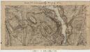
13B 8; 14A 5
1 : 50000 Lars Marius Bing Broch
14A Kongsberg
1 : 100000 Torgrim Lundtvedt | Johan Nordhagen
Spesielle kart 123-4: Kart over Drammensvassdraget
1 : 100000 Toralf à ̃yen
Portefølje nr 22
1 : 100000 Linthoe | Radich
Spesielle kart 58-5: Kart over Drammenselvens Flødningsdistrikt
1 : 100000 Thurmann | Seip
14A Kongsberg
1 : 100000 Ellef Nilsen | Torgrim Lundtvedt | Ole Tolstad
Portefølje nr 22
1 : 100000 Radich | Linthoe
Kartblad 22 øst: Vei-Kart over det Tindske Compagnie District; østre del
J. Dop
Geologiske kart 45: Geologisk kart over Østtelemarken
1 : 300000 Kjerulf | W. Werenskiold | Tellef Dahll