Maps of Osen

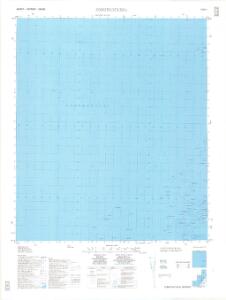
1523-1 Somstadflesa
1 : 50000 Statens kartverk
1523-1 Somstadflesa
1 : 50000 Norges Geografiske Oppmåling
1523-1 Somstadflesa
1 : 50000 Statens kartverk
1523-1 Somstadflesa
1 : 50000 Statens kartverk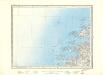
52B Ramsøy
1 : 100000 Arnt Magnus Andreassen Øgaard | C. Pedersen
52B Ramsøy
1 : 100000
52B Ramsø
1 : 100000 Arnt Magnus Andreassen Øgaard | Franck
52B Ramsø
1 : 100000 Arnt Magnus Andreassen Øgaard | Franck
52B Ramsø
1 : 100000 Arnt Magnus Andreassen Øgaard | Franck
Kartblad 98: Situations-Cart over det Biørnørsche Compagnie District
Grønn
Kartblad 99: Cart over det Biørnørske Compagnie District
Anthon Ulrich Holtermann
52B 3; 52B 7
1 : 50000 Ole Hagbart Bertrand Norgrenn
Trigonometrisk grunnlag, Squelet-Cart 37: Trigonometrisk Kart for 1828
1 : 400000 Vibe
Trigonometrisk grunnlag, Squelet-Cart 65-17

Museumskart 217-10: Kart over Den Norske Kyst fra Haltenøe til Lekøe
1 : 50000 H. Paludan | Vibe | Hagerup Opmaalings Directionen
Norge 55-1 Accurat landcaart over Norges Rige anden Part
1 : 3000000 G. Bordin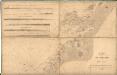
Museumskart 123: Kart over Den Norske Kyst fra Haltenøe til Lekøe
1 : 200000 Vibe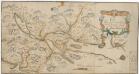
Kartblad 74: Carta over Eendeel af det Trondhiemske Primo-Regiement
Christian Wilhelm Klüwer
Statistikk 43-17-2: Bosettingskart over Namsos. Blad 17
1 : 250000 Statistisk Sentralbyrå
Statistikk 43-17- Bosettingskart over Namsos. Blad 17
1 : 250000 Statistisk Sentralbyrå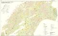
Geologisk kart 112: Kvartærgeologisk kart over Nord-Trøndelag og Fosen
1 : 250000 Geografisk institutt, Universitetet i Oslo
XVII
1 : 400000 K. Petersen
XVII
1 : 400000 K. Petersen
Spesielle kart 122-9: Postkart over Norge
1 : 400000 Toralf à ̃yen
Kartblad 73: Cartha over det Første Trundhiæmsche Regiments District
F. Klüwer
Statistikk 38-9: Bosettingskart over Norge. Blad 9
Statistisk Sentralbyrå
XIV
1 : 400000 K. Petersen
Kartblad 75: Situationskart over det Første Throndhiemske Infanteriregiments District
Hendrich Christoffer Eckleff
Museumskart 102: Situations Kaart over En Deel af den Norske Kyst, Todalsfjorden-Hanøya
1 : 40000