Maps of Vinje

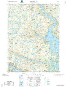
1514-4 Møsstrand
1 : 50000 Statens kartverk
1514-4 Mösstrand
1 : 50000 Norges Geografiske Oppmåling
1514-4 Mösstrand
1 : 50000 Statens kartverk
1514-4 Mösstrand
1 : 50000 Statens kartverk
1514-4 Bitdalsvatn
1 : 50000 Norges Geografiske Oppmåling
D35 aust Rauland
1 : 100000
D35 aust Rauland
1 : 100000
D35 aust Rauland
1 : 100000
D35 aust Rauland
1 : 100000
D35-3; D35-4; D35-5; D35-9; D35-10; D35-11; D36-10; D36-11
1 : 50000 Alf Hattestad
13C 6; 13C 7; 13C 10; 13C 11
1 : 50000 J. H. Aas
D35-5; D35-6; D35-11; D35-12; D36-11; D36-12; E35-1; E35-7
1 : 50000 Axel P. Printz
13C 5
1 : 50000 W. Næser
1514-3 Rauland
1 : 50000 Norges Geografiske Oppmåling
Kroki i 100000 over terrenget Mogen; Ugleflott; Haukeliseter
1 : 100000 Finn Qvale
Utsnitt av kroki over terrenget Mogen; Ugleflott og Haukeliseter
1 : 100000
Kart over terrenget Maar Gjøistavatn
1 : 100000 H. K. Hertzberg
D35-2; D35-3; D35-8; D35-9
1 : 50000 Hjalmar Skaar
D35
1 : 100000 Toralf Øyen
Kartblad 22 vest: Vei-Kart over det Tindske Compagnie District; vestre del
J. Dop
Statistikk 40- Oversiktskart over Hardangeviddas beiteforhold

Trigonometrisk grunnlag, Squelet-Cart 43: Kart over de i Sommeren 1847 trigonometrisk bestemte Punkter
C. Bassøe
Trigonometrisk grunnlag, Squelet-Cart 4 Kart over de Sommeren 1846 trigonometrisk bestemte Punkter
C. Bassøe
Portefølje nr 21
1 : 100000 H. Lassen
Spesielle kart 58-5: Kart over Drammenselvens Flødningsdistrikt
1 : 100000 Thurmann | Seip
Portefølje nr 21
1 : 100000 H. Lassen
Kartblad 145 øst: Cart over det 2det Westfieldske øwre Tellemarkske Compagnie District; østre del
Koss
D34-3; D34-4; D34-8; D34-9; D34-10
1 : 100000 Thorolv Ingar Ween
18A 2; 18A 3; 18A 4; 18A 6; 18A 7; 18A 8; 18A 11; 18A 12
1 : 100000 Magnus Engelschiøn