Maps of Aure

1421-4 Skardsøya
1 : 50000 Statens kartverk
1421-4 Skarsö
1 : 50000 Norges Geografiske Oppmåling
1421-4 Skardsöy
1 : 50000 Norges Geografiske Oppmåling
1421-4 Skardsøya
1 : 50000 Statens kartverk
1421-4 Skardsøya
1 : 50000 Statens kartverk
45D 7
1 : 50000 Sejersted | Gustav Heramd
45D 2
1 : 50000 A. Holm
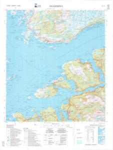
45D Edøy
1 : 100000
45D Edø
1 : 100000 Oluf Lier | Johan Nordhagen
45D Edø
1 : 100000 Johan Nordhagen | Oluf Lier
45D Edøy
1 : 100000
45D Edø
1 : 100000 Johan Nordhagen | Oluf Lier
45B 11; 45B 12; 45D 3; 45D 4
1 : 50000 Fredrik Wille
45D 6; 45D 10
1 : 50000 Hans Paasche Schreuder
45D 8; 45D 12
1 : 50000 Fredrik Christian Sejersted
45B 10
1 : 50000 Ole Hagbart Bertrand Norgrenn
Kartblad 112: Carte over det Wigsche-Nordmørsche Compagnie District
Johan Thomas Hornemann
1422-3 Sör-Fröya
1 : 50000 Norges Geografiske Oppmåling
1422-3 Sør-Frøya
1 : 50000 Statens kartverk
1422-3 Sør-Frøya
1 : 50000 Statens kartverk
48B 2
1 : 50000 Hans Paasche Schreuder
45D 11
1 : 50000 Gustav Heramd
Trigonometrisk grunnlag, Squelet-Cart 56: kart over de i Sommeren 1859 bestemte Punkter
A. Heiberg
Geologiske kart 121-J2: Kart med magnetisk totalfelt. Kristiansund
1 : 250000 Norges geologiske undersøkelse
Norge 55-14: Accurat landcaart over Norges Rige anden Part
1 : 3000000 G. Bordin
Trigonometrisk grunnlag, Squelet-Cart 65-15

Statistikk 43-15-2: Bosettingskart over Kristiansund. Blad 15
1 : 250000 Statistisk Sentralbyrå
Statistikk 43-15- Bosettingskart over Kristiansund. Blad 15
1 : 250000 Statistisk Sentralbyrå
Norge 32c: Cituations Carte over en vis Bestreckning nemblig fra Trundhiem og til Opdalen
1 : 300000 J. H. Emahusen