Maps of Lindesnes

1410-4 Lindesnes
1 : 50000 Norges Geografiske Oppmåling
1410-4 Lindesnes
1 : 50000 Norges Geografiske Oppmåling
1410-4 Lindesnes
1 : 50000 Norges Geografiske Oppmåling
1410-4 Lindesnes
1 : 50000 Statens kartverk
1410-4 Lindesnes
1 : 50000 Statens kartverk
Innseiling til Svinør
1 : 20000 Schie Opmaalings Directionen
1D Mandal
1 : 100000 H. Wangård | Oluf Lier
1D Mandal
1 : 100000 H. Wangård | Oluf Lier
1D Mandal
1 : 100000
1D 9
1 : 50000 Thomas Georg Backer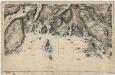
1D 5; 1D 6; 1D 9; 1D 10
1 : 50000 Paul Hansen Birch Brun
1D Mandal
1 : 100000 Oluf Lier | Ole Engh
Museumskart 217-25: Kart over Den Norske Kyst fra Christiansand til Lindesnæs
1 : 50000 H. Wille | Schie Opmaalings Directionen
Museumskart 65: Kart over Den Norske Kyst fra Christiansand til Lindesnæs
1 : 150000 Schie
1411-3 Lyngdal
1 : 50000 Statens kartverk
1411-3 Lyngdal
1 : 50000 Norges Geografiske Oppmåling
1411-3 Lyngdal
1 : 50000 Statens kartverk
1C Lodshavn
1 : 100000
1C Lodshavn
1 : 100000 Ole Engh | Ole Tostad
1C 12; 4A 4
1 : 50000 Thorlak Aas
1410-1 Ryvingen
1 : 50000 Statens kartverk
1D 7; 1D 11
1 : 50000 Gulbrandson | Lier | Hilmar Krogh Borchgrevinck
1410-1 Ryvingen
1 : 50000 Statens kartverk
1410-1 Ryvingen
1 : 50000 Norges Geografiske Oppmåling
1410-1 Ryvingen
1 : 50000 Norges Geografiske Oppmåling
1D 7; 1D 11
1 : 50000 Hilmar Krogh Borchgrevinck | Gulbrandson
1C 11; 1C 12; 4A 3; 4A 4
1 : 50000 Andreas Dahl
Indseilingen til Sæløer, Korshavn, Ullerøsund, Lodshavn, Ekvaag og Farsund
1 : 20000 Schie Opmaalings Directionen
1D 10
1 : 50000 Gulbrandson | Frithjof Jacobsen