Maps of Skånland

1332-2 Astafjorden
1 : 50000 Norges Geografiske Oppmåling
1332-2 Astafjord
1 : 50000 Norges Geografiske Oppmåling
1332-2 Astafjorden
1 : 50000 Statens kartverk
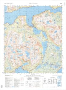
1332-2 Astafjorden
1 : 50000 Statens kartverk
1332-2 Astafjorden
1 : 50000 Statens kartverk
Krokering nr 46
1 : 100000 Widerberg
M9 nordøstre del
1 : 50000 Georg Ferdinand Rubach | Halle
N9 nv/4
1 : 50000 Carl Aksel S. Sissener | Einar C. I. N. Michelsen
M8 sørøstre del
1 : 50000 Carl Ludvig Soelberg
1332 Ofotenhalvøya
1 : 100000 Statens kartverk
M9 Ofoten
1 : 100000 Ole Engh | Arnt Magnus Andreassen Øgaard
N9 Narvik
1 : 100000 Torgrim Lundtvedt | Ole Engh
Krokering nr 31
1 : 100000 Lund
Norway 1:100,000 , Series GSGS 4090, Ofoten
Norway 1:100,000 , Series GSGS 4090. Great Britain. War Office. General Staff. Geographical Section. [London] : War Office
M9 Ofoten
1 : 100000
M9 Ofoten
1 : 100000 Arnt Magnus Andreassen Øgaard | Ole Engh
M9 Ofoten
1 : 100000
M9 Ofoten
1 : 100000
M9 Ofoten
1 : 100000 Ole Engh | Arnt Magnus Andreassen Øgaard
M9 Ofoten
1 : 100000
Krokering nr 74
1 : 200000 Lund
Krokering nr 49
1 : 100000 Widerberg
N8 sv/4
1 : 50000 Thorleif Barlag
N9 Narvik
1 : 100000 C. Pedersen | Torgrim Lundtvedt
N9 Narvik
1 : 100000
M9 sørøstre del
1 : 50000 Haakon Schive
N8 Salangen
1 : 100000 Johan Gulbrandsen Natrud | Ole Engh
N9 Narvik
1 : 100000
Norway 1:100,000 , Series GSGS 4090, Harstad
Norway 1:100,000 , Series GSGS 4090. Great Britain. War Office. General Staff. Geographical Section. [London] : War Office