Maps of Tingvoll

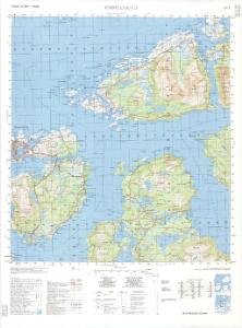
1321-2 Kristiansund
1 : 50000 Norges Geografiske Oppmåling
1321-2 Kristiansund
1 : 50000 Statens kartverk
1321-2 Kristiansund
1 : 50000 Statens kartverk
45A 3; 45A 4; 45A 7; 45A 8
1 : 50000 Nicolai Magnus Widerberg
45B 1; 45B 2; 45B 5; 45B 6
1 : 50000 Johan Iversen
45B 9
1 : 50000
Kartblad 120: Carte over det Gimniske Compagnie
Johan Christopher Wessel Tordenskiold
Kartblad 119: Situations Kaart over det Gimnatsche Compagnie District
Johan Christian Richelieu
Kartblad 118: Vei-Kort over det Gangnatiske Compagnie District
Elias Nægler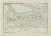
Kartblad 121- Vei Kort over det Giemniske Compagnie District; versjon 1
Christian Nicolai Dagenboldt
1321-1 Smöla
1 : 50000 Norges Geografiske Oppmåling
41D 9
1 : 50000 Eiler Christian Holtermann
45A 11; 45A 12; 45C 3; 45C 4
1 : 50000
1320-1 Tingvoll
1 : 50000 Statens kartverk
1320-1 Tingvoll
1 : 50000 Statens kartverk
1320-1 Tingvoll
1 : 50000 Norges Geografiske Oppmåling
41C 8; 41C 12; 41D 5; 41D 9
1 : 50000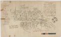
Kartblad 112: Carte over det Wigsche-Nordmørsche Compagnie District
Johan Thomas Hornemann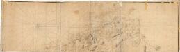
Museumskart 100a: Speciel Kaart over en Deel af den Norske Kyst fra Christianssund til Bergens Stifts Grændse.
1 : 75000 Carl Frederik Grove | Niels Andreas Wibe
1321-1 Smöla
1 : 50000 Norges Geografiske Oppmåling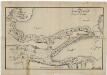
Kartblad 121-2: Vei Kort over det Giemniske Compagnie District; versjon 2 (+ informasjon 2b)
Christian Nicolai Dagenboldt
1421-3 Halsa
1 : 50000 Norges Geografiske Oppmåling
1421-3 Halsa
1 : 50000 Statens kartverk
45B 10
1 : 50000 Ole Hagbart Bertrand Norgrenn
1321-1 Smöla
1 : 50000 Statens kartverk
1321-1 Smöla
1 : 50000 Statens kartverk
Norge 55-14: Accurat landcaart over Norges Rige anden Part
1 : 3000000 G. Bordin
Museumskart 217-68: Kart over Havbankerne Langs den Norske Kyst fra Stadt til Smølen
1 : 200000 M. Lyng Den Geografiske Opmaaling
Statistikk 43-15-2: Bosettingskart over Kristiansund. Blad 15
1 : 250000 Statistisk Sentralbyrå