Maps of Farsund

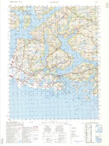
1311-2 Farsund
1 : 50000 Norges Geografiske Oppmåling
1311-2 Farsund
1 : 50000 Norges Geografiske Oppmåling
1311-2 Farsund
1 : 50000 Statens kartverk
1311-2 Farsund
1 : 50000 Norges Geografiske Oppmåling
1311-2 Farsund
1 : 50000 Statens kartverk
1311-2 Farsund
1 : 50000 Statens kartverk
1C 11; 1C 12; 4A 3; 4A 4
1 : 50000 Andreas Dahl
1C 12; 4A 4
1 : 50000 Thorlak Aas
Indseilingen til Sæløer, Korshavn, Ullerøsund, Lodshavn, Ekvaag og Farsund
1 : 20000 Schie Opmaalings Directionen
1C 11; 4A 2; 4A 3
1 : 50000 Johan Ferdinand Normann
Museumskart 217-28: Innseilingskart til Flekkefjord, Egersund, Sogndalstranda m.fl.
1 : 20000 Schie Opmaalings Directionen
4A 7
1 : 50000 Thomas Georg Backer
Innseiling til Flekkefjord
1 : 20000 Schie Opmaalings Directionen
4A Flekkefjord
1 : 100000 Torgrim Lundtvedt | C. Pedersen
Geologisk kart 3-1b: Snitt over det Søndenfjeldske Norge
1 : 200000 P. Waage | H. Mohn | Tellef Dahll | A. S. Bachke
4A Flekkefjord
1 : 100000 C. Pedersen | Torgrim Lundtvedt
4A Flekkefjord
1 : 100000
4A Flekkefjord
1 : 100000
4A Flekkefjord
1 : 100000 Torgrim Lundtvedt | C. Pedersen
Kartblad 160: Situations Carte den südwestlichen Theil des Capitain Arctanders Compagnie District
Loewenthael
4A 7 4A 8 4A 11 4A 12
1 : 50000 Andreas Dahl
4A 11 4A 12
1 : 50000 Daniel TÃ ̧nnesen
1D 9
1 : 50000 Thomas Georg Backer
4A 8
1 : 50000 Thomas Georg Backer
1311-1 Flekkefjord
1 : 50000 Norges Geografiske Oppmåling
4A 2 4A 6
1 : 50000 Jacob Ræder
4A 6
1 : 50000 Thorlak Aas
Innseiling til Rasvåg og Kirkehavn
1 : 20000 Schie Opmaalings Directionen
Portefølje nr 1
1 : 100000 F. Næser | H. Gill