Maps of Eigersund

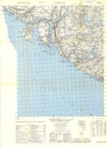
1211-1 Egersund
1 : 50000 Norges Geografiske Oppmåling
1211-1 Egersund
1 : 50000 Statens kartverk
1211-1 Egersund
1 : 50000 Statens kartverk
1211-1 Egersund
1 : 50000 Norges Geografiske Oppmåling
1211-1 Egersund
1 : 50000 Norges Geografiske Oppmåling
3B 12 3D 4
1 : 50000 T. A. Henriksen
3D 3
1 : 50000 Gulbrandson | David Vogt | Ivar Lund
Innseiling til Egersund
1 : 20000 Schie Opmaalings Directionen
3B 12
1 : 50000 David Vogt
3D 3 (en del)
1 : 50000 Ivar Lund
3D 3 3D 6 3D 7
1 : 50000 Gulbrandson
3D Egersund
1 : 100000 Tolstad | Finn Abrahamson
3D Egersund
1 : 100000 Finn Abrahamson | Tolstad
3D Egersund
1 : 100000 Tolstad | C. Pedersen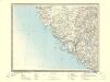
3D Egersund
1 : 100000
3D Egersund
1 : 100000 Tolstad | C. Pedersen
3D 3 3D 6 3D 7 3D 11 3D 8
1 : 50000 T. A. Henriksen
3D 4 4C 1
1 : 50000 David Vogt
3D 8 3D 12
1 : 50000 Daniel TÃ ̧nnesen
B39-6; C39-1
1 : 50000 Axel P. Printz
Spesielle kart 36: Egersund - Flekkefjordbanen
1 : 200000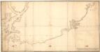
Museumskart 72: Kyststrekningen fra Sireåen til Tungenes
1 : 20000 Rasmus Iuel
Trigonometrisk grunnlag, Squelet-Cart 47: Kart for 1851
C. S. Grimsgaard
Spesielle kart 13: Kart over den projekterede Jernbanelinie mellem Stavanger og Ekersund
1 : 200000
Kartblad 15 Situations Cart over det 1ste Stavangerske Compagnie District
C. Tobiesen
Museumskart 217-27: Kart over Den Norske Kyst fra Lindesnæs til Ekersund
1 : 50000 H. Wille | Schie Opmaalings Directionen
Museumskart 217-29: Kart over Den Norske Kyst fra Ekersund til Stavanger og Hvidingsø-fyr
1 : 50000 H. Wille | Schie Opmaalings Directionen
Museumskart 66: Kart over den Norske kyst fra Lindesnæs til Ekersund
1 : 100000 H. Wille | Schie
Museumskart 217-2 Kart over Den Norske Kyst fra Christiansand til Ekersund
1 : 50000 H. Wille | Schie Opmaalings Directionen