Maps of Vestvågøy

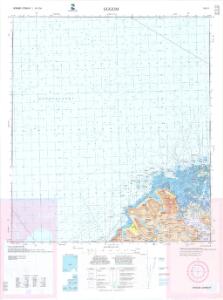
1031-1 Eggum
1 : 50000 Statens kartverk
1031-1 Eggum
1 : 50000 Norges Geografiske Oppmåling
1031-1 Eggum
1 : 50000 Statens kartverk
1031-1 Eggum
1 : 50000 Statens kartverk
J9 Kvalnes
1 : 100000
J9 Kvalnes
1 : 100000
J9 Kvalnes
1 : 100000 Johan Gulbrandsen Natrud | C. Pedersen
J9 Kvalnes
1 : 100000 Johan Gulbrandsen Natrud | C. Pedersen
J9 Kvalnes
1 : 100000
J10 Vestvaagø
1 : 100000 Johan Gulbrandsen Natrud | C. Pedersen
J10 Vestvaagø
1 : 100000 Johan Gulbrandsen Natrud | C. Pedersen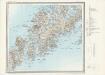
J10 Vestvågøy
1 : 100000
J10 nordvestre del
1 : 50000 Carl Olsen
J10 Vestvaagø
1 : 100000 Johan Gulbrandsen Natrud | C. Pedersen
J10 Vestvågøy
1 : 100000
J10 Vestvaagø
1 : 100000
J10 Vestvågøy
1 : 100000
J10 Vestvågøy
1 : 100000
J10 nordøstre del og J9 sørøstre del
1 : 50000 Carl Oscar Munthe | Carl Olsen | Carl Peter Bruun
J10 nordøstre del
1 : 50000 Carl Oscar Munthe | Carl Olsen
Lofoten
1 : 250000 Bernh. Tolstad | O. Engh
Lofoten
1 : 250000 Bernh. Tolstad | O. Engh
Geologiske kart 121-R: Kart med magnetisk totalfelt. Svolvær
1 : 250000 Norges geologiske undersøkelse
Statistikk 43-23-2: Bosettingskart over Svolvær. Blad 23
1 : 250000 Statistisk Sentralbyrå
Lofoten
1 : 250000 Bernh. Tolstad | O. Engh
Lofoten
1 : 250000 Bernh. Tolstad | O. Engh
Statistikk 43-23- Bosettingskart over Svolvær. Blad 23
1 : 250000 Statistisk Sentralbyrå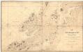
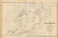
Museumskart 139: Kart over Den norske kyst fra Tranø til GiSund med Vesteraalen og den nordlige deel af Lofoten
1 : 200000 Vibe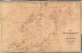
Trigonometrisk grunnlag, vedlegg 62: Kart over Den Norske Kyst fra Tranø til Gi Sund
1 : 200000 Rynning | Due | Hagerup | Vibe