Maps of Røst

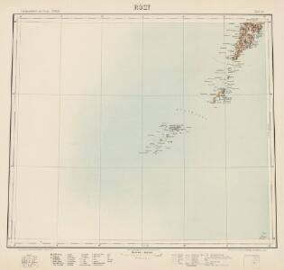
Røst
1 : 250000 O. Engh | E. Daarstad
Røst
1 : 250000 E. Daarstad | O. Engh
Røst
1 : 250000 E. Daarstad | O. Engh
Røst
1 : 250000 E. Daarstad | O. Engh
Museumskart 14 Hav området utenfor kysten mellom Tranøy og Gisund
1 : 50000
I11 Lofotodden
1 : 100000 C. Pedersen | Johan Gulbrandsen Natrud
I11 Lofotodden
1 : 100000 C. Pedersen | Johan Gulbrandsen Natrud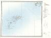
H12, I12 Røst
1 : 100000
I11 Lofotodden
1 : 100000
H12, I12 Røst
1 : 100000 Carl Peter Bruun | Carl Christian P. Olberg
H12, I12 Røst
1 : 100000 Carl Peter Bruun | Carl Christian P. Olberg
I11 Lofotodden
1 : 100000
H12, I12 Røst
1 : 100000 Carl Peter Bruun | Carl Christian P. Olberg
H12, I12 Røst
1 : 100000 Carl Peter Bruun | Carl Christian P. Olberg
H12, I12 Røst
1 : 100000 Carl Peter Bruun | Carl Christian P. Olberg
I11 Lofotodden
1 : 100000
I11 Lofotodden
1 : 100000 Johan Gulbrandsen Natrud | H. C. Wanggård
I11 Lofotodden
1 : 100000 Johan Gulbrandsen Natrud | C. Pedersen
I11 Lofotodden
1 : 100000 Johan Gulbrandsen Natrud | H. C. Wanggård
I11 Lofotodden
1 : 100000 Johan Gulbrandsen Natrud | H. C. Wanggård
I11 Lofotodden
1 : 100000 Johan Gulbrandsen Natrud | C. Pedersen
I11 Lofotodden
1 : 100000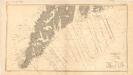
Museumskart 185: Den norske kyst fra Lofotodden til Ure
1 : 50000 C. Bruun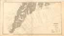
Museumskart 186: Den norske kyst fra Lofotodden til Ure
1 : 50000 C. Bruun
1729-1 Røst
1 : 50000 Statens kartverk
1830-3 Væröy
1 : 50000 Statens kartverk
1830-1 Lofotodden
1 : 50000 Statens kartverk
1830-3 Væröy
1 : 50000 Norges Geografiske Oppmåling
1729-1 Røst
1 : 50000 Statens kartverk