Maps of Kongsvinger

Maps of Kongsvinger

$title$

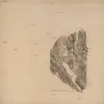
Nr. 8; felt 3 halve sør og 7

1 : 25000 J. Natrud
$title$

Nr. 8; felt 7

1 : 25000 Stugstad
$title$

Nr. 8; felt 4 og søndre del av 8

1 : 25000 Hans Løken | J. Natrud
$title$

20B 6

1 : 50000 Johannes Solem
$title$

Fra Fulu til Tarven

1 : 20000 J. H. Reichborn
$title$

Kartblad III: Kart over Postveien fra Gaarden Kløften i Ullensager Sogn om Magnor til Rigsgrændsen

1 : 20000 J. H. Reichborn
$title$

Mil nr 99

1 : 10000 Niels Stockfleth Darre
$title$

Trigonometrisk grunnlag, vedlegg 18: Fundament Mensul for Quadrat-Milen No 92

1 : 10000 Niels Andreas Wibe | Hans Nicolai Archtander
$title$

Mil nr 100

1 : 10000 Ditlef Wibe
$title$

20B-6-øst

1 : 10000 Hans Nicolai Archtander | Hans Frederich Tambs
$title$

20B 7 vest

1 : 10000 Hans Gløersen
$title$

Trigonometrisk grunnlag, vedlegg 19: Fundament Mensul for Quadrat-Milen No 93

1 : 10000 Niels Andreas Wibe | Hans Nicolai Archtander
$title$

Nr. 8; felt 2 og 6 (en del)

1 : 25000 I. Smith-Kielland
$title$

20B-6-sø

1 : 10000 Hans Frederich Tambs | Hans Nicolai Archtander
$title$

20B-7-nv

1 : 10000
$title$

20B-6-nø

1 : 10000 Hans Nicolai Archtander | Hans Frederich Tambs
$title$

20B-7-sv

1 : 10000
$title$

Fra Kongetorp til Gropa

1 : 20000 J. H. Reichborn
$title$

Norge 266: Situasjonsplan over terrenget ved Lier 1808

Johnson
$title$

Kongsvinger

1 : 50000 Gerhard Munthe | Niels Arentz Ramm
$title$

2015-2 Kongsvinger

1 : 50000 Norges Geografiske Oppmåling
$title$

2015-2 Kongsvinger

1 : 50000 Statens kartverk
$title$

2015-2 Kongsvinger

1 : 50000 Statens kartverk
$title$

Nr. 8; felt 5; 6; 9 og 10

1 : 25000 O. J. Broch | H. Broch
$title$

20B 7

1 : 50000 Abraham Ludvig Amundsen
$title$

Nr. 8; felt 10 halve nord

1 : 25000 J. Nielsen
$title$

Nr. 8; felt 11 østre halve og en del av 10

1 : 25000 H. K. Hertzberg | O. J. Broch
$title$

Nr. 8; dele av felt 5 og 9

1 : 25000 R. Roscher Nielsen
$title$

Nr. 8; felt 11 østre del og 12 vestre del

1 : 25000 T. A. Dahl
$title$

Nr. 8; felt 13

1 : 25000 O. Berg
© MapTiler © OpenStreetMap contributors
How does it work?
These instructions will show you how to find historical maps online.
Getting started
Type the place name in the search box to find the exact location. You can further adjust the search by zooming in and out.
Zoom
Zoom in and out with the buttons or use your mouse or touchpad natively.
Exact Area tool
Click here and draw a rectangle over the map to precisely define the search area.
Set filters
Narrow your search with advanced settings, such as Years (from/to), Fulltext, Publisher, etc.
Results
See the results of your search on the right side. You can scroll down to find more maps of this location.
?

Download OldMapsOnline Mobile